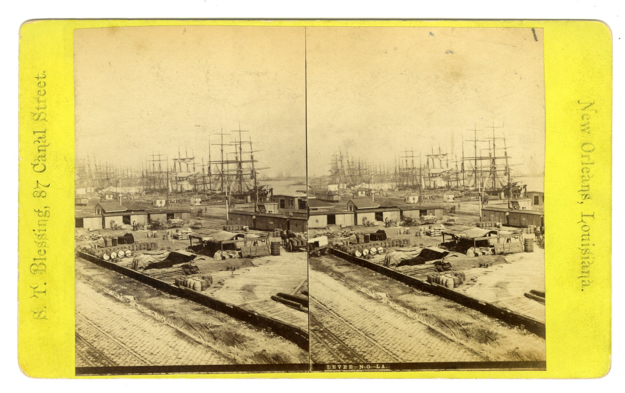
LOU47. S.T. Blessing, New Orleans. Levee, N.O. VG. $65

LOU52. S.T. Blessing, New Orleans. No. 668. Swamp Scenery. VG. $45

LOU57. S.T. Blessing, New Orleans. No. 414. Bird’s-Eye Panoramic View, No. 5. Taken from St. Patrick’s Church Spire, looking North. G. $75

LOU85. No ID. Canal St. to Christ Church. Stamp on verso “From M. Miller, Dealer in Photographs, Stereoscopic Views, Etc. 7 Charles St.” VG. $175
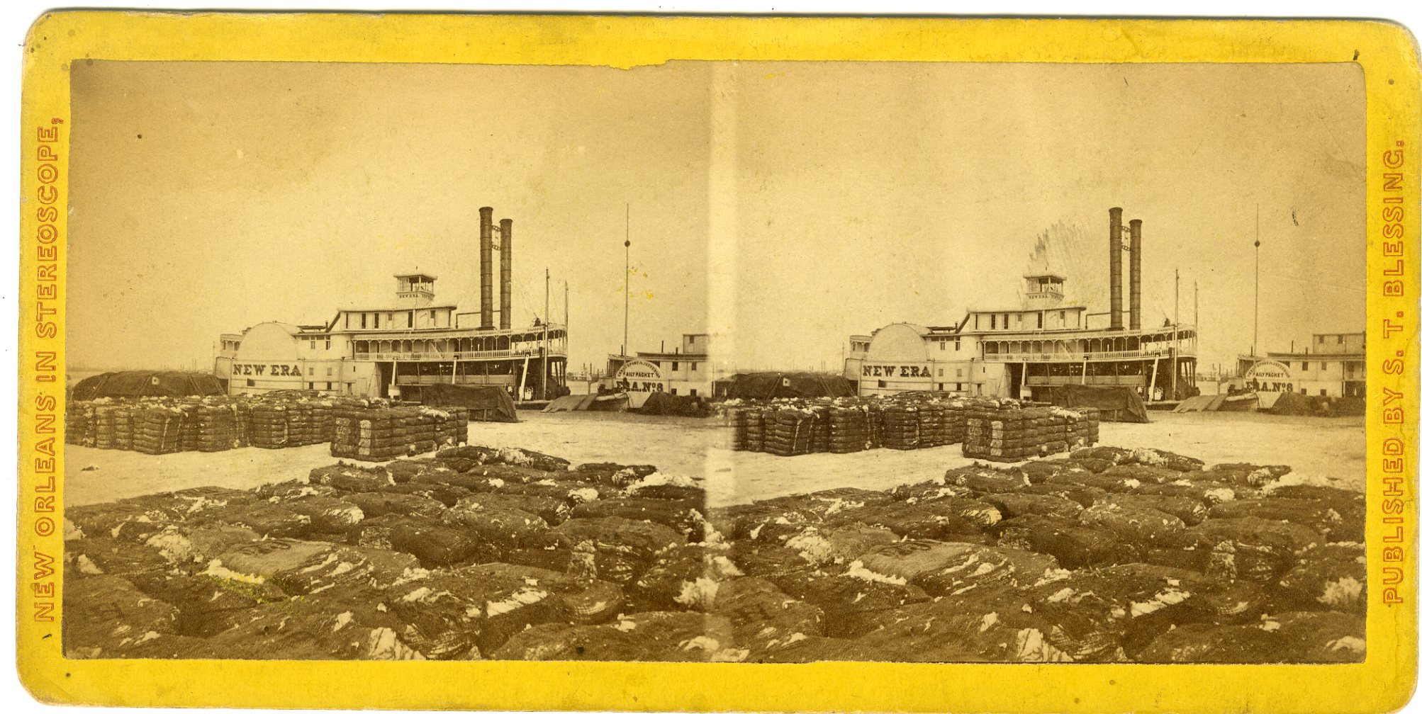
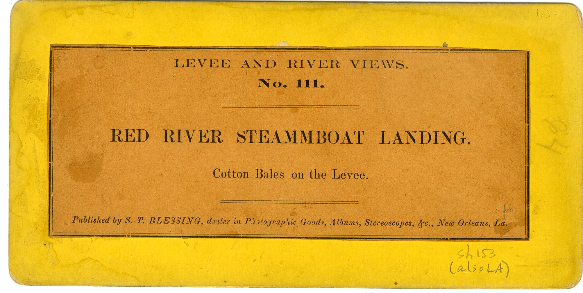
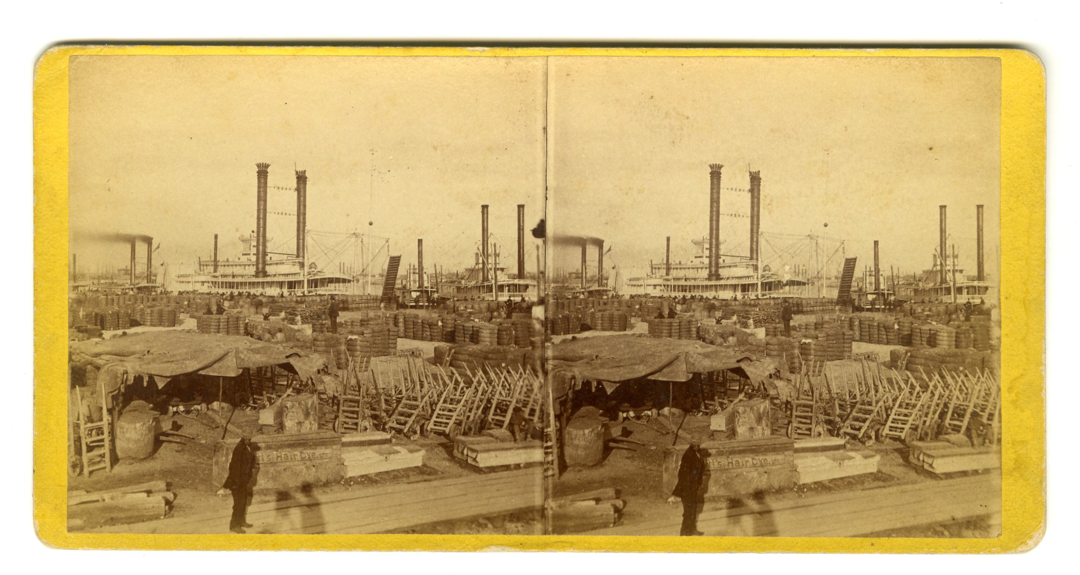
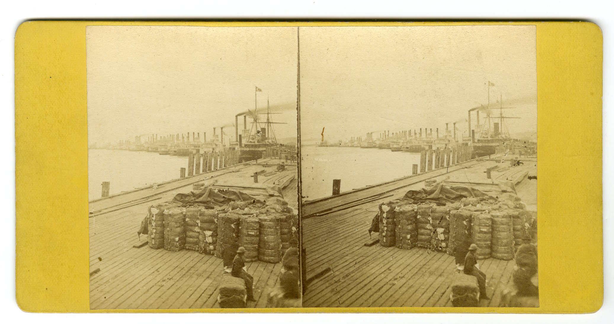
SH153. S.T. Blessing. Levee and River Views. No. 111. Red River Steamboat Landing. Cotton Bales on the Levee. This is the Steamboat “New Era.” VG. $95

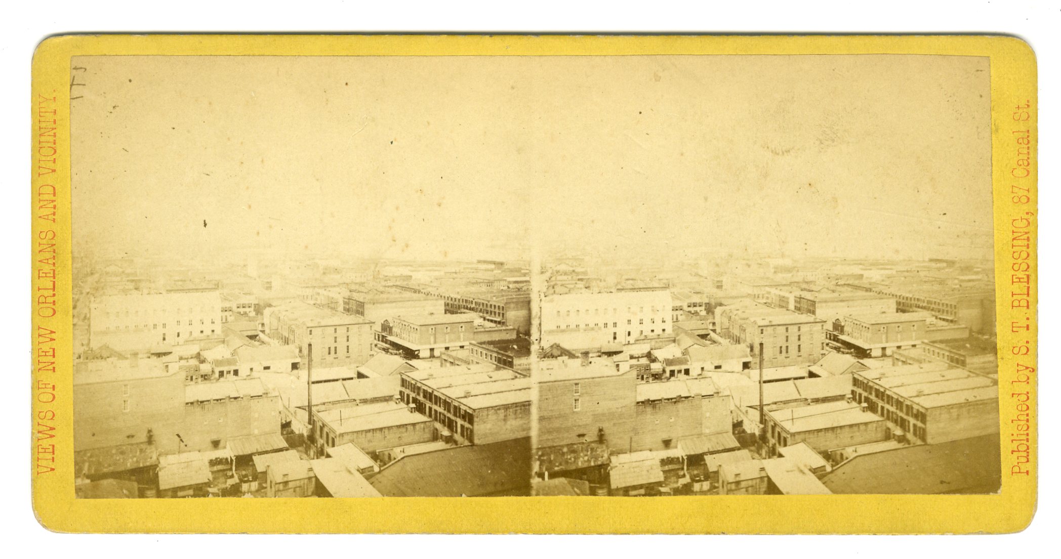
LOU119. No photographer ID. Views in New Orleans. Panoramic View. G. $65

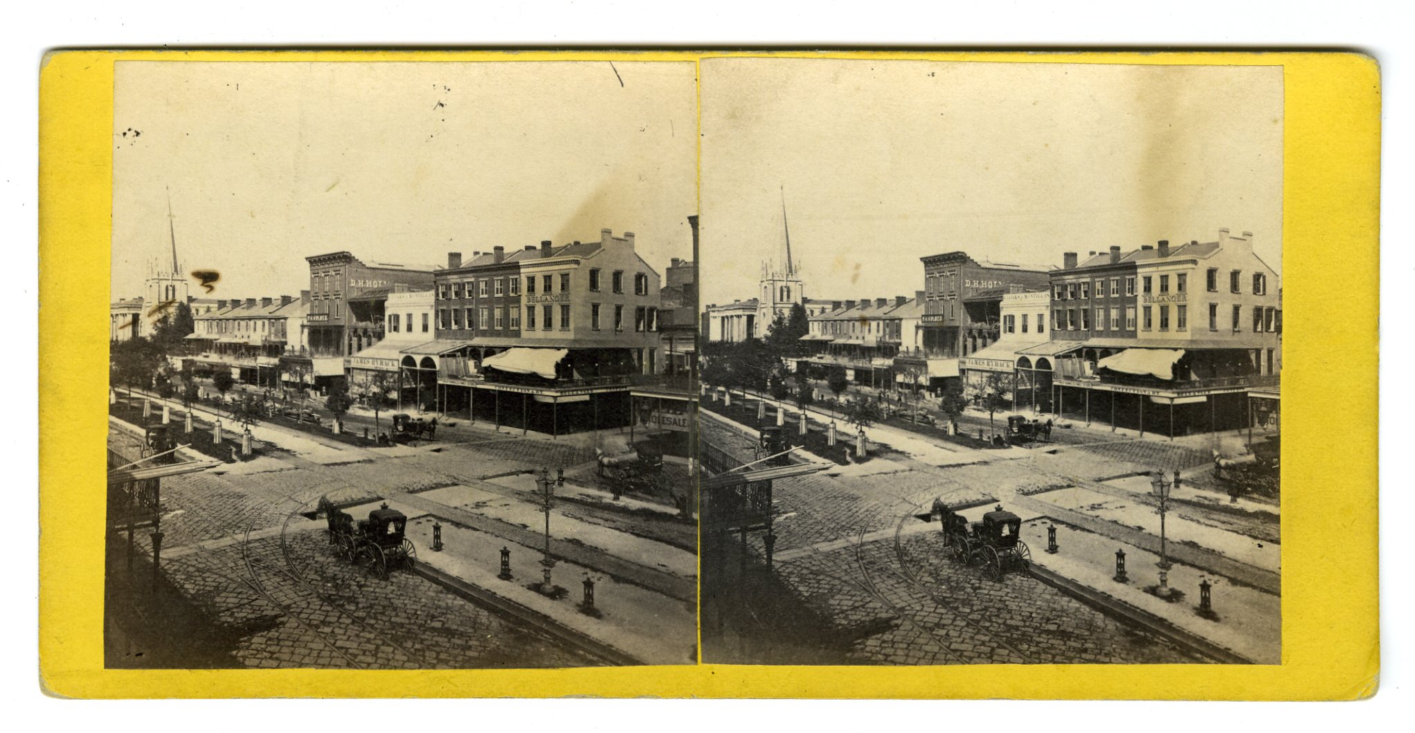
LOU121. W.H. Leeson, New Orleans. Canal St. The photography gallery of William H. Washburn can be seen behind and just to the left of the statue. G. $150
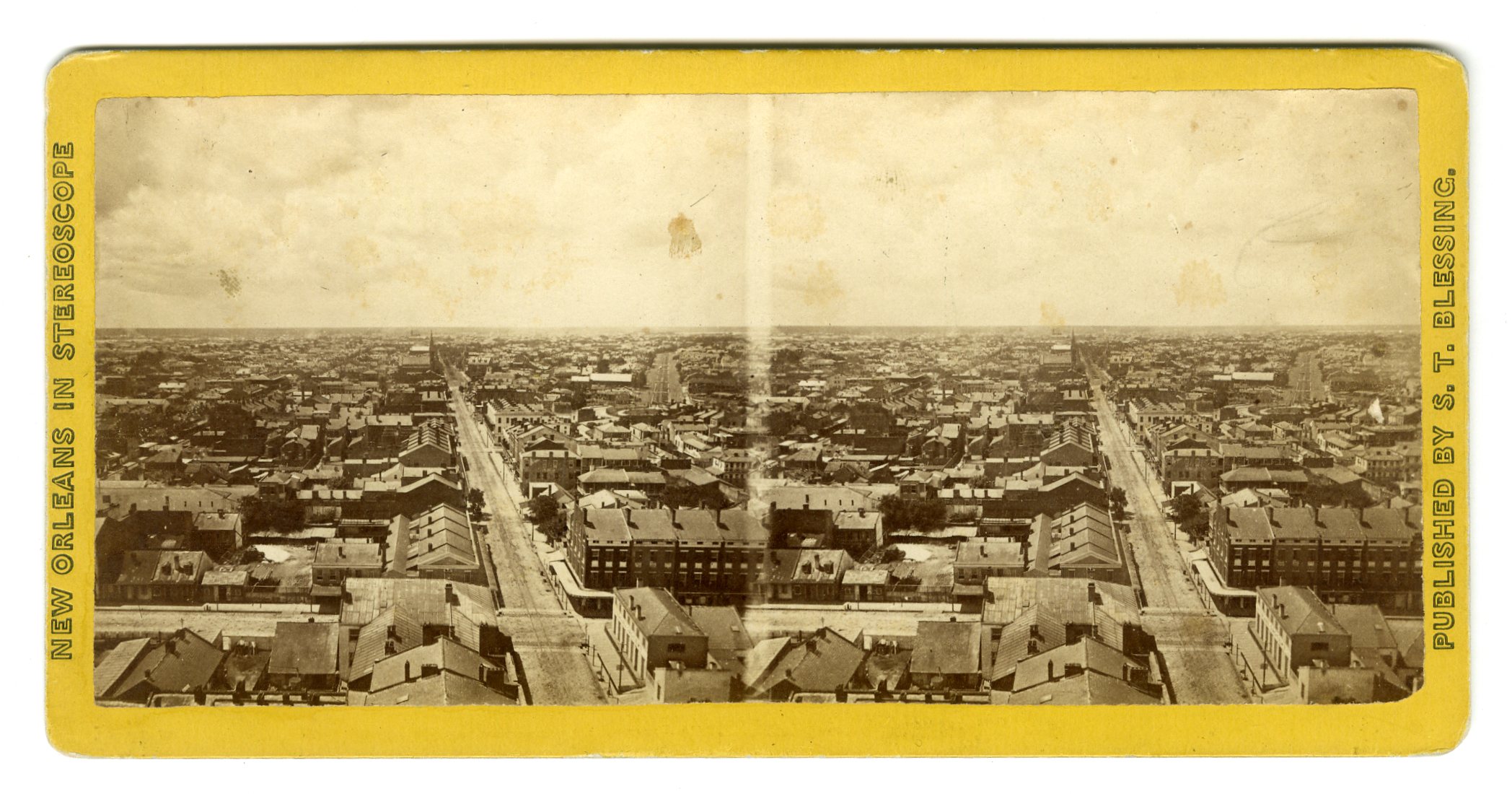
LOU122. S.T. Blessing, New Orleans. Views of New Orleans, No. 410. Bird’s-Eye Panoramic View, No. 1, Taken from St. Patrick’s Church Spire, looking South. This View, with seven others, Nos. 1 to 8, or negatives 410 to 417 inclusive, forms a Panorama of the whole City. G. $125

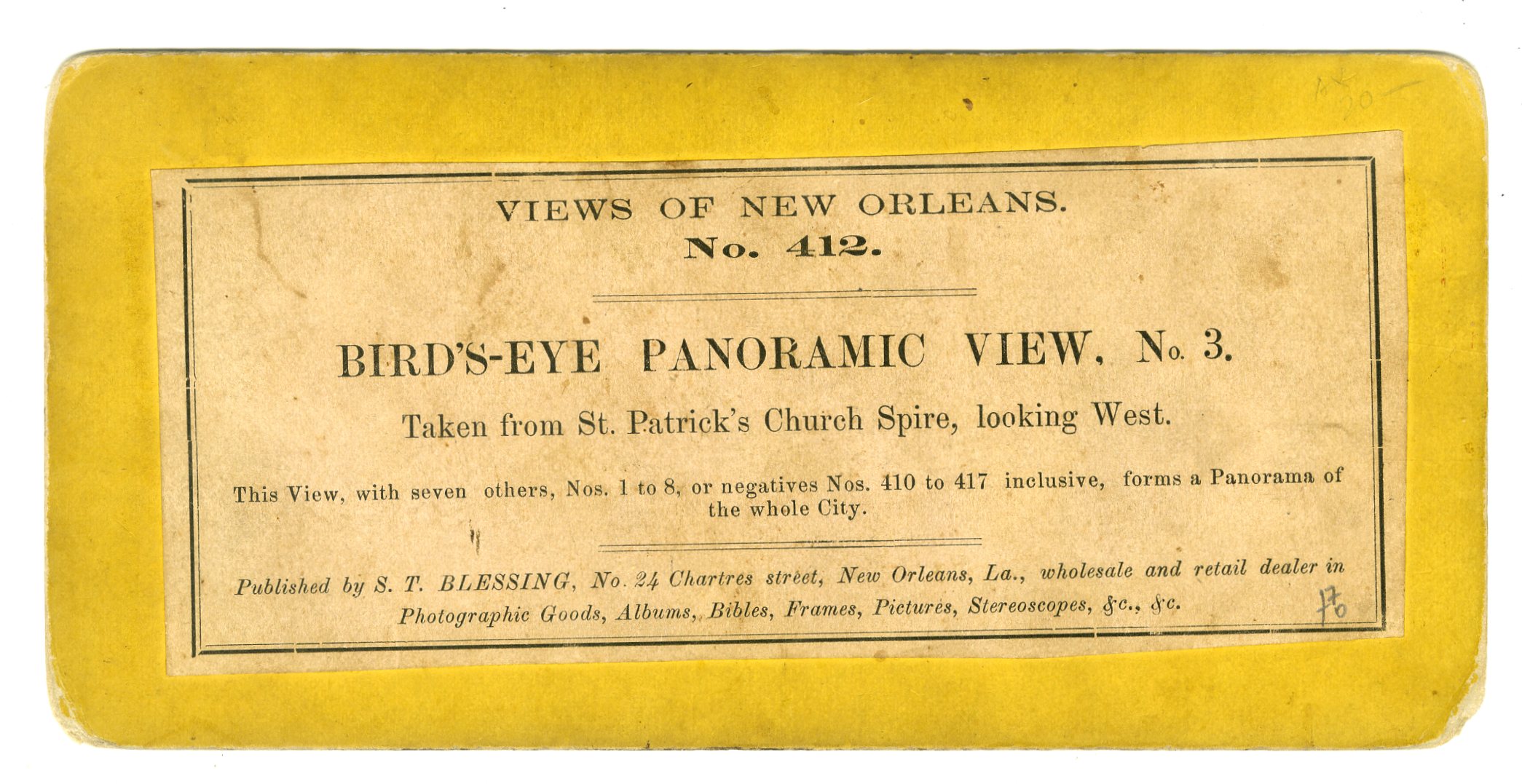
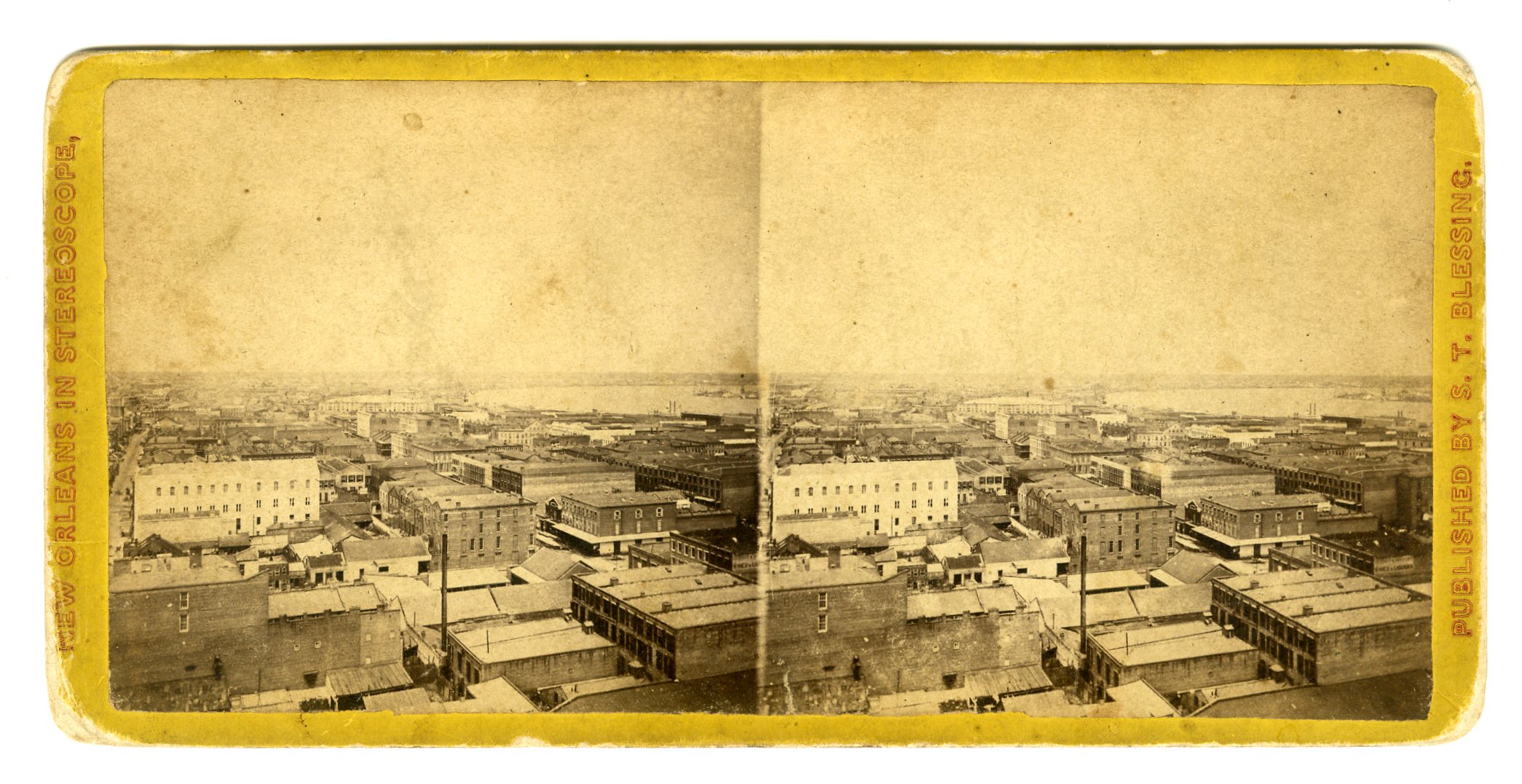
LOU124. S.T. Blessing, New Orleans. Views of New Orleans, No. 412. Bird’s-Eye Panoramic View, No. 3, Taken from St. Patrick’s Church Spire, looking West. This View, with seven others, Nos. 1 to 8, or negatives 410 to 417 inclusive, forms a Panorama of the whole City. G. $125

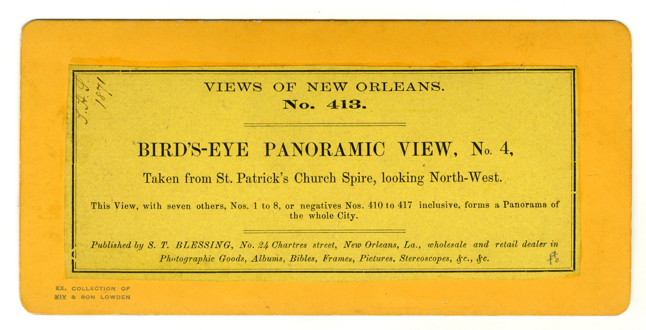
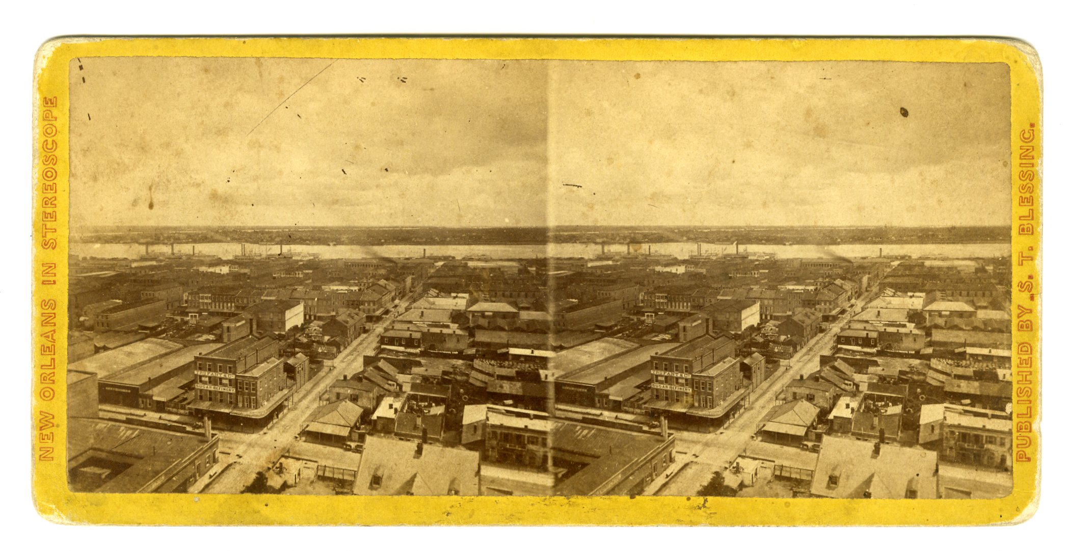
LOU125. S.T. Blessing, New Orleans. Views of New Orleans, No. 413. Bird’s-Eye Panoramic View, No. 4, Taken from St. Patrick’s Church Spire, looking North-West. This View, with seven others, Nos. 1 to 8, or negatives 410 to 417 inclusive, forms a Panorama of the whole City. VG. $150

LOU126. S.T. Blessing, New Orleans. Views of New Orleans, No. 414. Bird’s-Eye Panoramic View, No. 5, Taken from St. Patrick’s Church Spire, looking North. This View, with seven others, Nos. 1 to 8, or negatives 410 to 417 inclusive, forms a Panorama of the whole City. G. $125

LOU128. S.T. Blessing, New Orleans. Views of New Orleans, No. 416. Bird’s-Eye Panoramic View, No. 7, Taken from St. Patrick’s Church Spire, looking East, showing the River, McDonoghburg, and the River again in the distance. This View, with seven others, Nos. 1 to 8, or negatives 410 to 417 inclusive, forms a Panorama of the whole City. G. $125
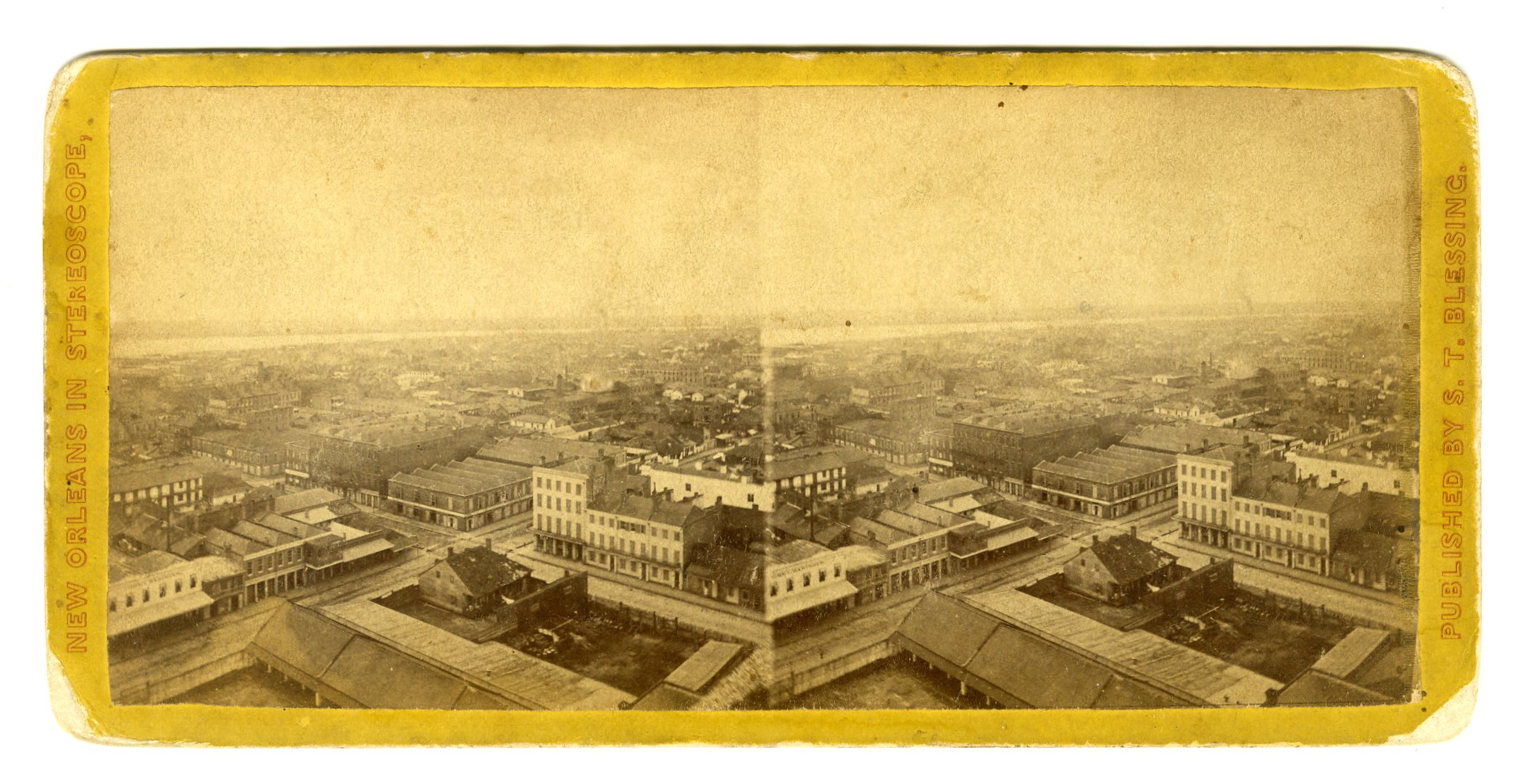
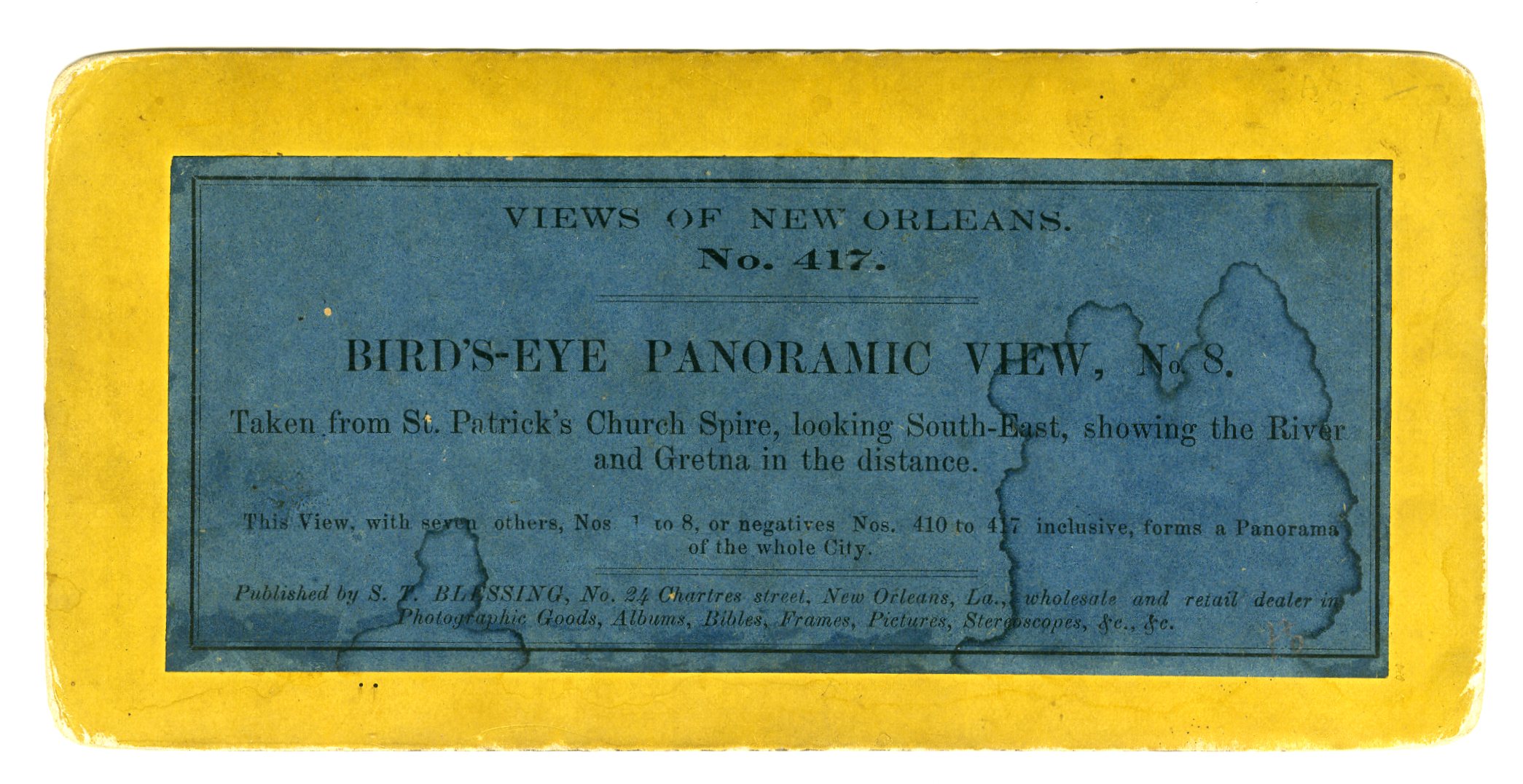
LOU129. S.T. Blessing, New Orleans. Views of New Orleans, No. 417. Bird’s-Eye Panoramic View, No. 8, Taken from St. Patrick’s Church Spire, looking South-East, showing the River and Gretna in the distance. This View, with seven others, Nos. 1 to 8, or negatives 410 to 417 inclusive, forms a Panorama of the whole City. G. $125
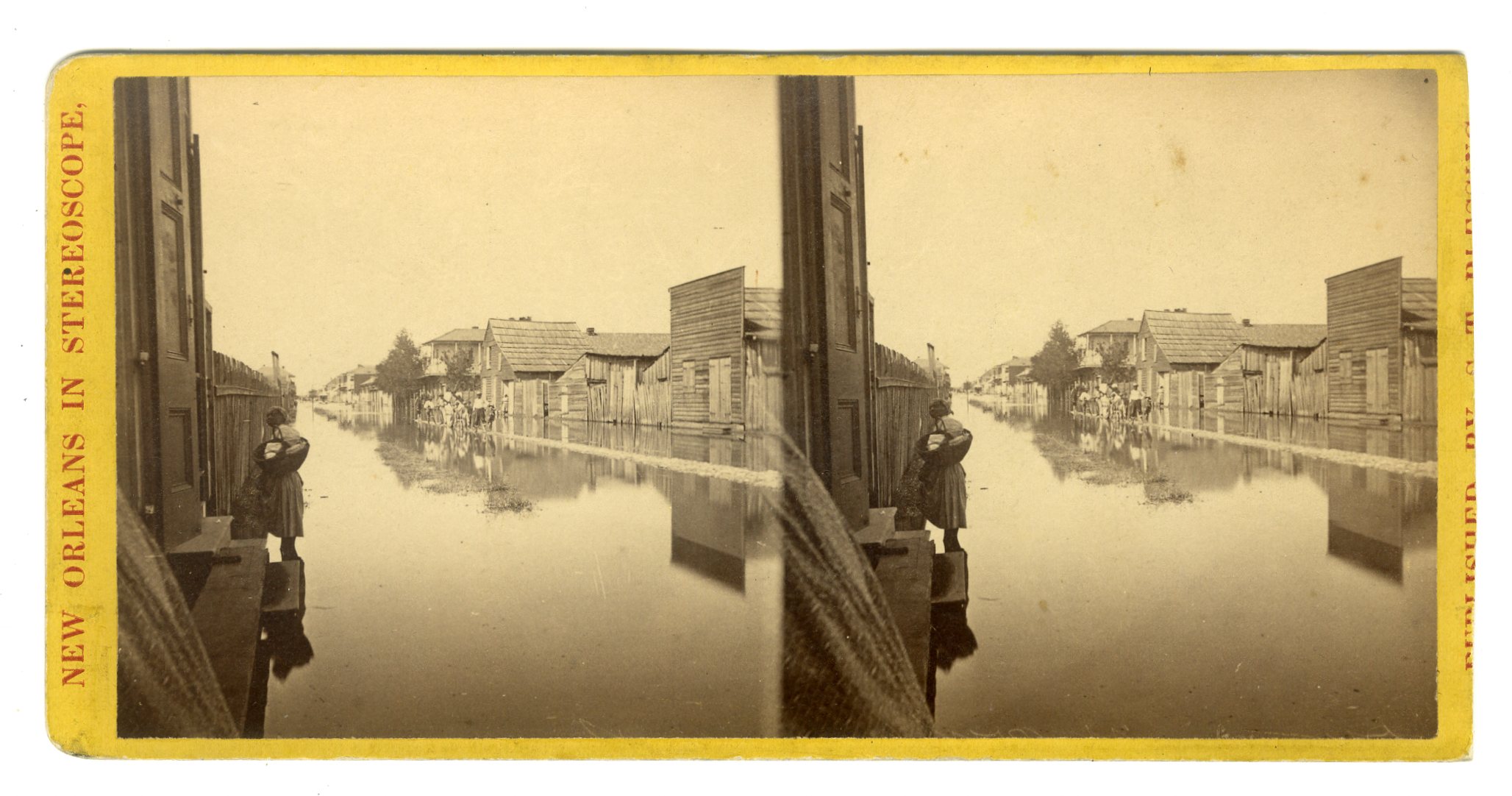
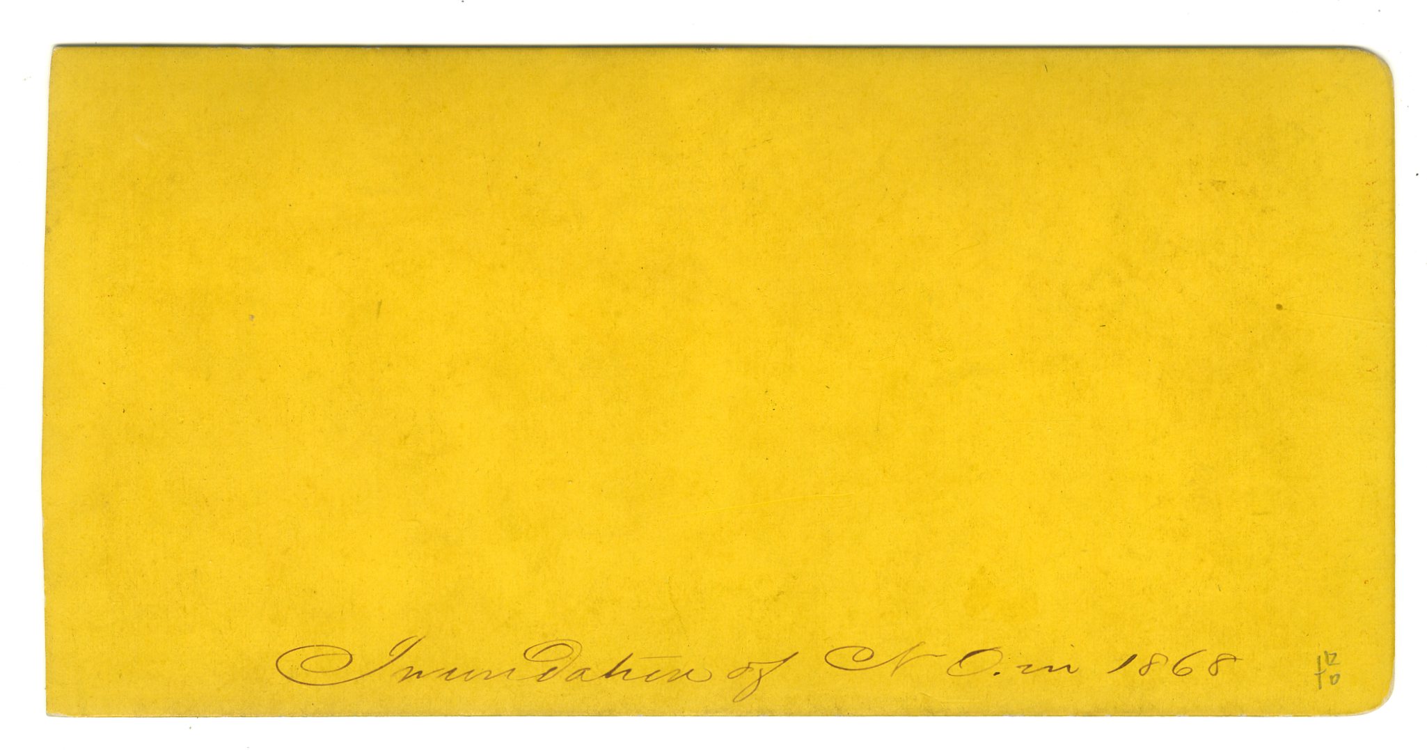
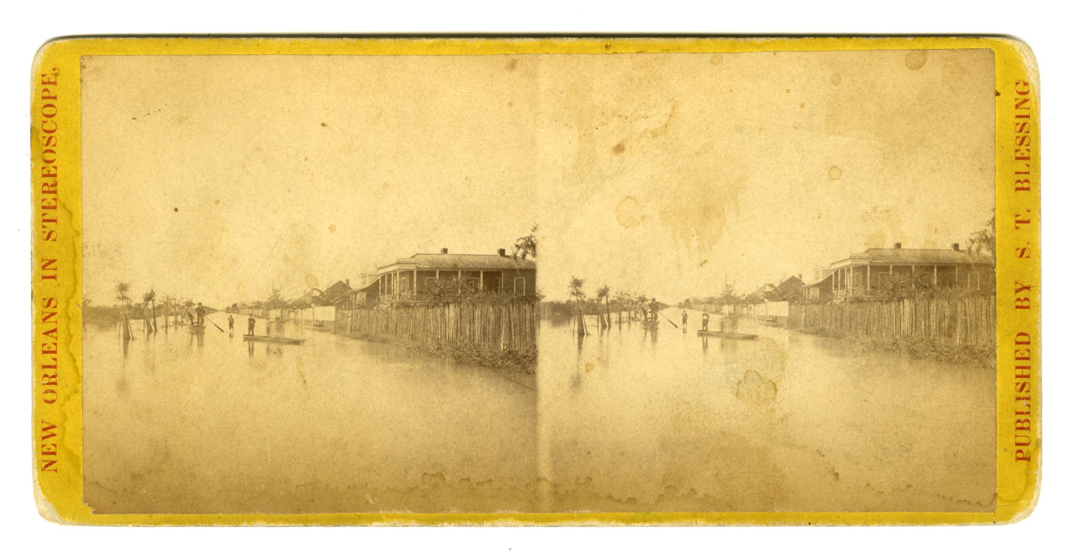
LOU130. S.T. Blessing, New Orleans. Inundation of New Orleans, 1868. Trimmed at right margin. VG. $250

LOU131. S.T. Blessing, New Orleans. Inundation of New Orleans, 1868. G. $175
![]()
LOU132. Theo. Lilienthal, New Orleans. Note from a previous owner of this view: “Exceedingly Rare. Building on far right is “Harvey Castle” on West Bank of Miss.” Here is the interesting tale of Harvey Castle:
Harvey Castle (or Harvey’s Castle), was razed over a century ago at a site on the West Bank of Jefferson Parish, far from the renowned historic neighborhoods of New Orleans proper. Why is it remembered? Perhaps for its sheer distinction — its whimsy, its folly, its visible salience — or for that all-important historical marker, which stands today on Destrehan Avenue at Fourth Street in Harvey.
Yet, like even the most famous of local historic structures, the details of Harvey Castle are less known, and worth recounting.
Harvey Castle was built in 1846 along the Destrehan Canal, today’s Harvey Canal, and although it was designed as a residential mansion, the structure was used just as much as an office for canal operations, making it vital to the economic development of what is now Harvey. That waterway was the brainchild of Nicholas Noel Destrehan, a maverick landholder and entrepreneur who, in the late 1830s, had one eye on the abundant natural resources of the Barataria Basin to his south, and the other on his neighbors to the west, who were tapping into that largesse via the Company Canal in modern-day Westwego.
In 1839, Destrehan decided to hire a team of Irish “ditchers” to excavate his own channel to connect with Bayou Barataria and points south. Completed by 1844, Destrehan’s canal soon became busy with barges, luggers and schooners hauling timber, moss, finfish, shellfish and game in from swamps, marshes and bays. In short time, Destrehan earned a fortune by charging tolls for vessels to sail there from the Mississippi River via a “marine railway” he designed to get over the levee, a lock being too risky.
Keen in commerce and a tad eccentric, Destrehan had all along been working on a “castle” for his canal-side plantation. He called it the Louisiana Lyceum and Museum, for his collection of art and curios, although snickering neighbors were more inclined to call the five-story edifice “Destrehan’s Folly.”
Equally keen was Destrehan’s daughter Louise, who was born in 1827 and raised steeped in the Catholic French Creole culture of the rural West Bank (known as the Right Bank at the time). In 1845, Louise married a Scotts-Irish adventurer from what is now West irginia by the name of Joseph Hale Harvey, who her father had approved as worthy of his daughter as well as the future helmsman of the family empire.
After twin wedding ceremonies — one Protestant, one Catholic — and a year-long international honeymoon, Joseph and Louise Harvey returned home and got started building a house befitting the West Bank’s newest power couple. Thus arose Harvey Castle.
A family descendant described the manse as a “medieval, two turreted baronial castle patterned from a faded old picture of [Joseph’s] grandfather’s and great uncle’s home in Scotland.” Inside the three-story edifice were walnut-finished walls, marble mantels imported from Italy, 18-foot-high ceilings and two grand staircases. Outside were ornamental gardens with various flowering plants, fruits, vegetables, shade trees and walkways, which together with the house spanned roughly a full city block about 300 feet from the river.
Building materials came from local sources. “The brick was a product of the town of Harvey,” wrote the New Orleans States years later, “as was the cement, which was made of oyster shells and river sand.” Harvey Castle was built by free men of color “living in what was then ‘Free Town,’ now McDonoghville, be it said to the credit of these men and their skill and industry.”
According to historian William D. Reeves, Harvey Castle was a Victorian Gothic answer to the elder Destrehan’s own live-in art museum, that five-story “vaguely Palladian” folly that remained unfinished when it burned to the ground in 1852. Its demise left Harvey Castle as the premier landmark in the vicinity, visible for miles across the river. Inside, Joseph and Louise raised their growing family, and oversaw their multi-use plantation, the economic lynchpin of which was the now-renamed Harvey Canal.
Why build a plantation house to look like a castle? Some surmised a connection to Joseph Harvey’s ancestral home in Scotland. Others suggested it reflected Harvey’s years as a Mississippi riverman, where he would have seen how the elaborate adornment on steamboats had inspired comparable detailing on some plantation houses (witness the “steamboat gothic” style of the San Francisco Plantation House in Garyville).
As for the Destrehan side of the family, the taste may have betrayed a provincial yearning to showcase its claims to an aristocratic French lineage. Commented a tutor who lived with the Destrehans the same year Harvey Castle was constructed, “As had long been the custom here with Creole families of sufficient means, the sons…were sent back to the home of their ancestry to receive a more systematic and thorough training. Mr. Destrehan thus in early years imbibed tastes and ideas in La Belle France, [including] an architectural taste, and a wish to reproduce here some of the old baronial structures of that land.”
There may have been broader design fashions at play, as the “castle look” was popular in the Romanticist-inspired architecture of this era, particularly for riverfront buildings. The U.S. Marine Hospital, built in McDonoghville starting in 1834, sported Gothic towers and battlements, as did the twin Belleville Iron Works in Algiers, which had citadel-like turrets.
As for Louise, she focused on running the family enterprise as well as raising her family under the crenelated towers of Harvey Castle. After her father’s death in 1848, Louise, now 21, became proprietor of the canal (along with 26,000 acres of Joseph’s inherited Virginia land), and co-owner of a community estate that included 76 enslaved people inherited from her father. Louise Destrehan Harvey ranked among the wealthiest and most powerful women in greater New Orleans in this era, and her empire rested largely on enslaved people — and that waterway to Barataria riches.
Harvey Castle was a silent witness to each subsequent phase of West Bank history. It saw the arrival of the railroad and a drawbridge in the 1850s; occupying Union troops in the 1860s; the postbellum transformation of enslaved plantations to leased truck farms; cattle drives from Texas and the rise of riverfront industry; and attempt after frustrating attempt to build a suitable river lock for the Harvey Canal.
In 1874, when the Jefferson Parish seat of Carrollton was annexed into the City of New Orleans and a need arose for a new parish courthouse, Louise Destrehan Harvey decided to lease Harvey Castle for that purpose. In April 1874, the “Police Jury of Jefferson, Right Bank” took occupancy in Harvey Castle, despite that it lacked legal authority to pay rent for it.
After three years of waiting, Louise filed suit for the $3,400 owed to her. But judges ruled against her, even as she allowed the Police Jury to stay while trying to persuade the jurors to purchase the property. She finally evicted them in 1884 — the queen of the castle ejecting a freeloader government. Homeless again, the Police Jury eventually settled into William Tell Hall, still standing on Newton and Third streets in Gretna. Jefferson Parish government remains in Old Gretna to this day.
In 1898, at age 71, Louise made a key decision to incorporate The Harvey Canal Land and Improvement Company. She arranged to keep control within the family, and installed her son Horace as manager. Horace Harvey endeavored to bring the operation into the 20th century, and that meant a renewed effort to build a modern lock. Between 1902 and 1907, after numerous travails including the death of Louise at age 77, engineers finally succeeded in completing a strong new lock where the Harvey Canal adjourned the Mississippi River.
That success led to the demise of Harvey Castle. As the U.S. Army Corps of Engineers pieced together a public barge canal stretching along the Gulf Coast from Texas to Florida, it contemplated how to bring this new national asset through the Port of New Orleans. After a years-long competition with the Company Canal in Westwego, government authorities decided in 1919 to select the Harvey Canal for their project, which became today’s Gulf Intracoastal Waterway (GIWW).
While the government would now own the actual channel of the Harvey Canal, the Harvey Canal Land and Improvement Company would retain control of all wharves and canal-side facilities, now positioned to boom with oil-related economic activity. It also still owned Harvey Castle, which it leased to tenants.
But the impending boom did not bode well for the aging citadel. Corps engineers, upon taking control of the channel in 1924, promptly set about updating the facilities and widening the channel. The aging mansion stood in the way, and the solution was an expedient one. “Harvey Castle, Across the River…To Be Demolished,’ reported the New Orleans States on May 18, 1924. It was gone by year’s end. A decade later, the Corps spent $2 million to replace Horace Harvey’s lock with a new 425-foot-long, 75-foot-wide, 12-foot-deep lock.
Today, 300 feet from the interior gate of that same lock, stands a historical market at the intersection of Highway 18 and Destrehan Avenue. “HARVEY CASTLE SITE,” it reads, “Gothic Revival home of Marie Louise Destrehan and her husband Joseph Hale Harvey; it served as the third courthouse of Jefferson Parish, 1874-84. Located east side of Destrehan Avenue 450 north of railroad. Demolished 1924 to enlarge Harvey Canal and Locks.”
That marker, the endurance of the Harvey Canal as part of the GIWW, the sheer oddity and salience of Harvey Castle, has kept its fame alive to this day. “Known from one end of the Mississippi River to the other,” wrote the States newspaper of Harvey Castle in 1925, the mansion served river pilots who “took their bearings from its lofty turrets” as they steered around the great crescent.
The organization founded by its original occupant, the Harvey Canal Limited Partnership, retains control of the waterway’s bankside land to this day, and is controlled entirely by the descendants of the Destrehans and the Harveys. The company’s logo, which appears on its letterhead and website, features the distinctive profile of Harvey Castle. G. $175
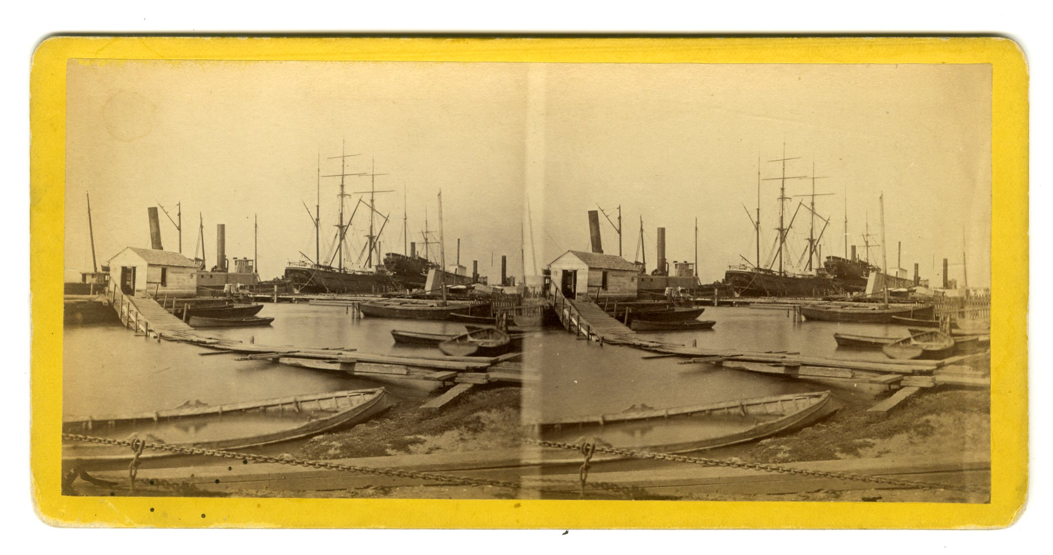

LOU133. S.T. Blessing, New Orleans. No. 201. Algiers Dry Dock. E. $200
![]()
LOU135. Theo. Lilienthal, New Orleans. 29. Levee and Steamboat Landing. Looks like one can see the shadow of the photographer at right. VG. $150
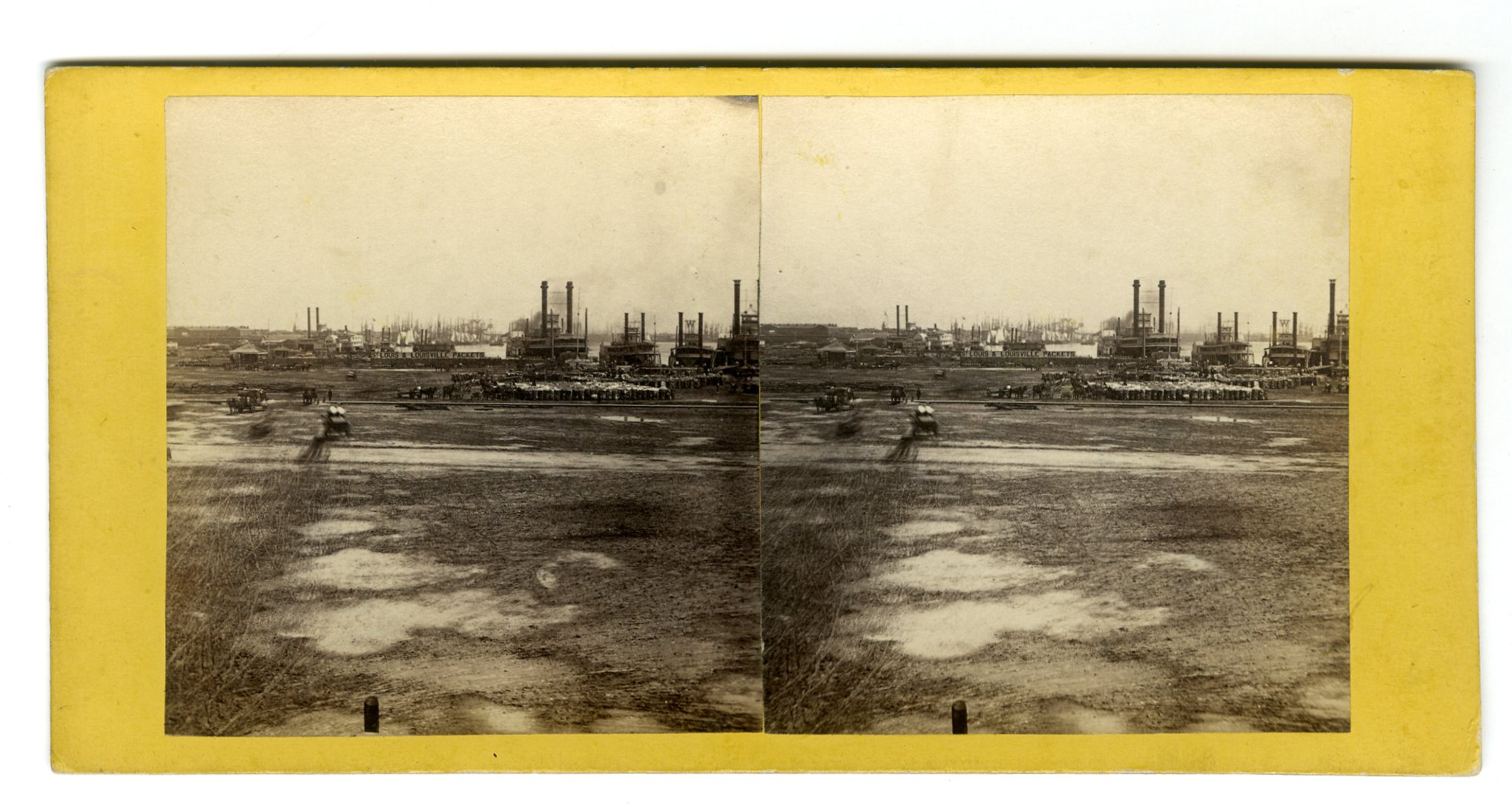
LOU137. Theo. Lilienthal, New Orleans. Levee, foot of Bienville Street. VG. $150
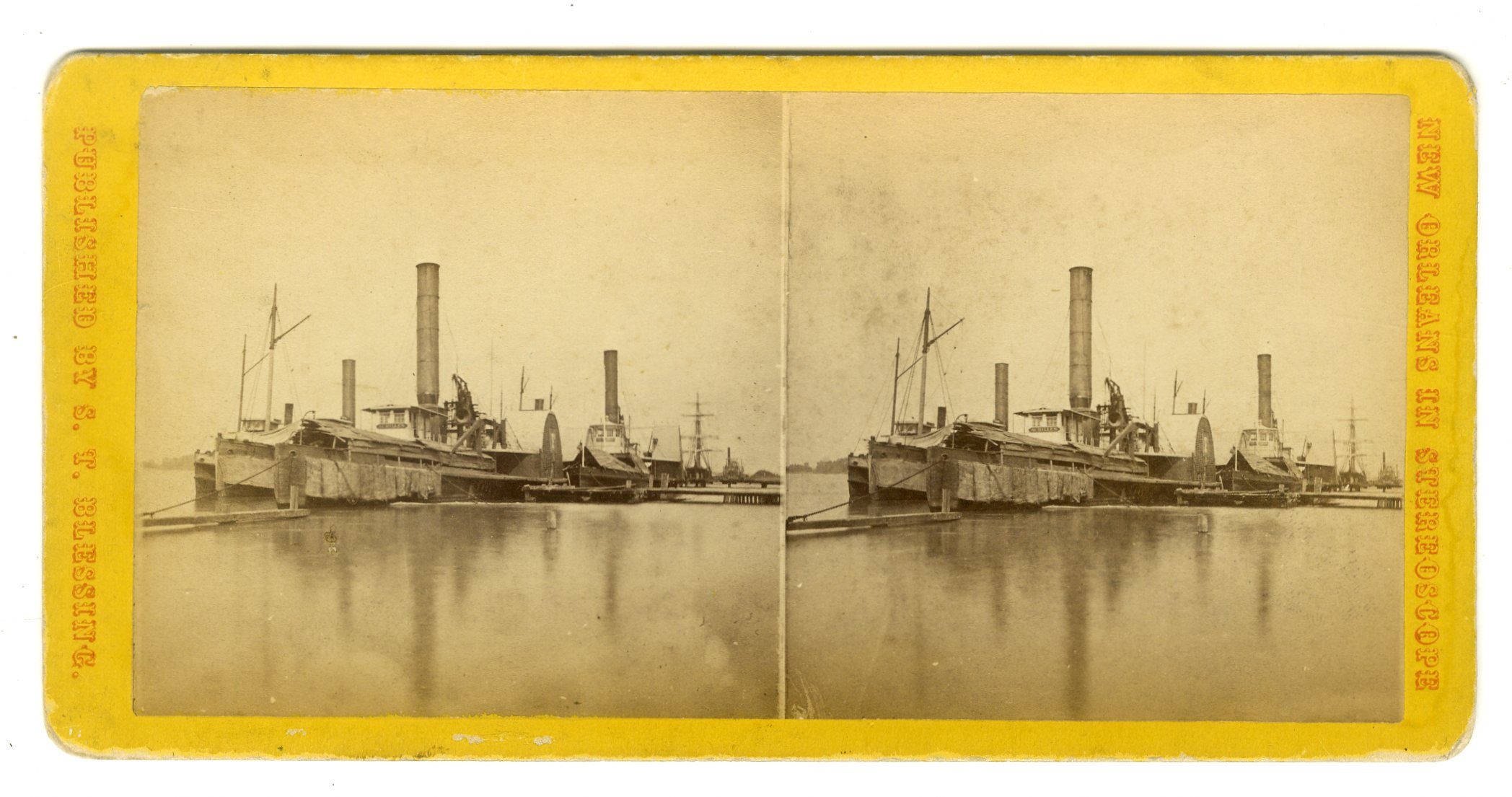
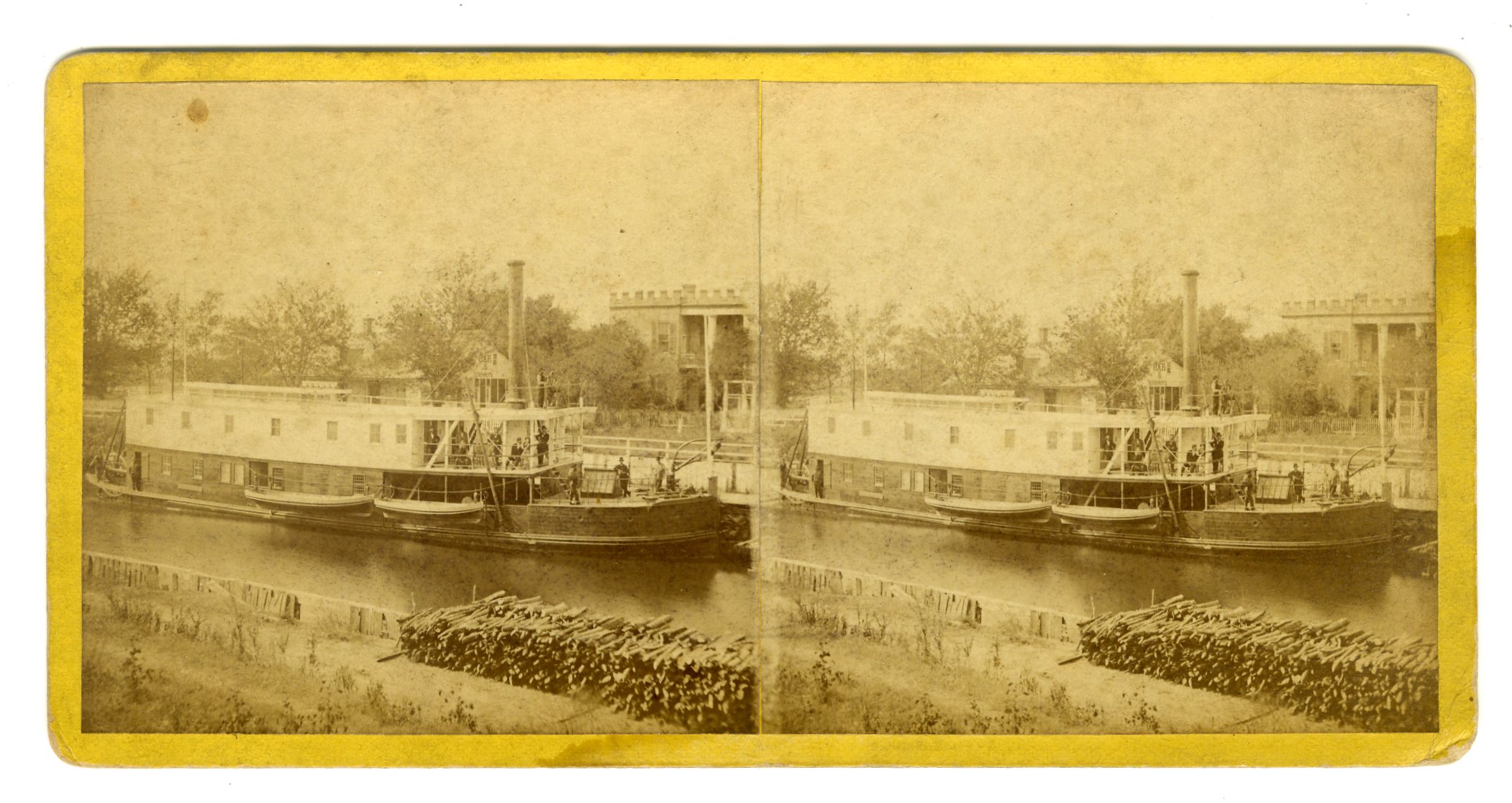
LOU138. S.T. Blessing, New Orleans. No. 202. Towboat Station, Algiers. VG. $175


LOU139. No photographer ID, probably Theo. Lilienthal. Untitled levee with barrels and cotton, houses at left. Note on verso indicates that this view is “ex-Darrah Coll.” E. $150
![]()
LOU140. Theo. Lilienthal, New Orleans. 29. Levee and Steamboat Landing. This is the same title as Lou135 above but an entirely different scene. The shadow of the photographer is clearly seen at bottom. VG. $175
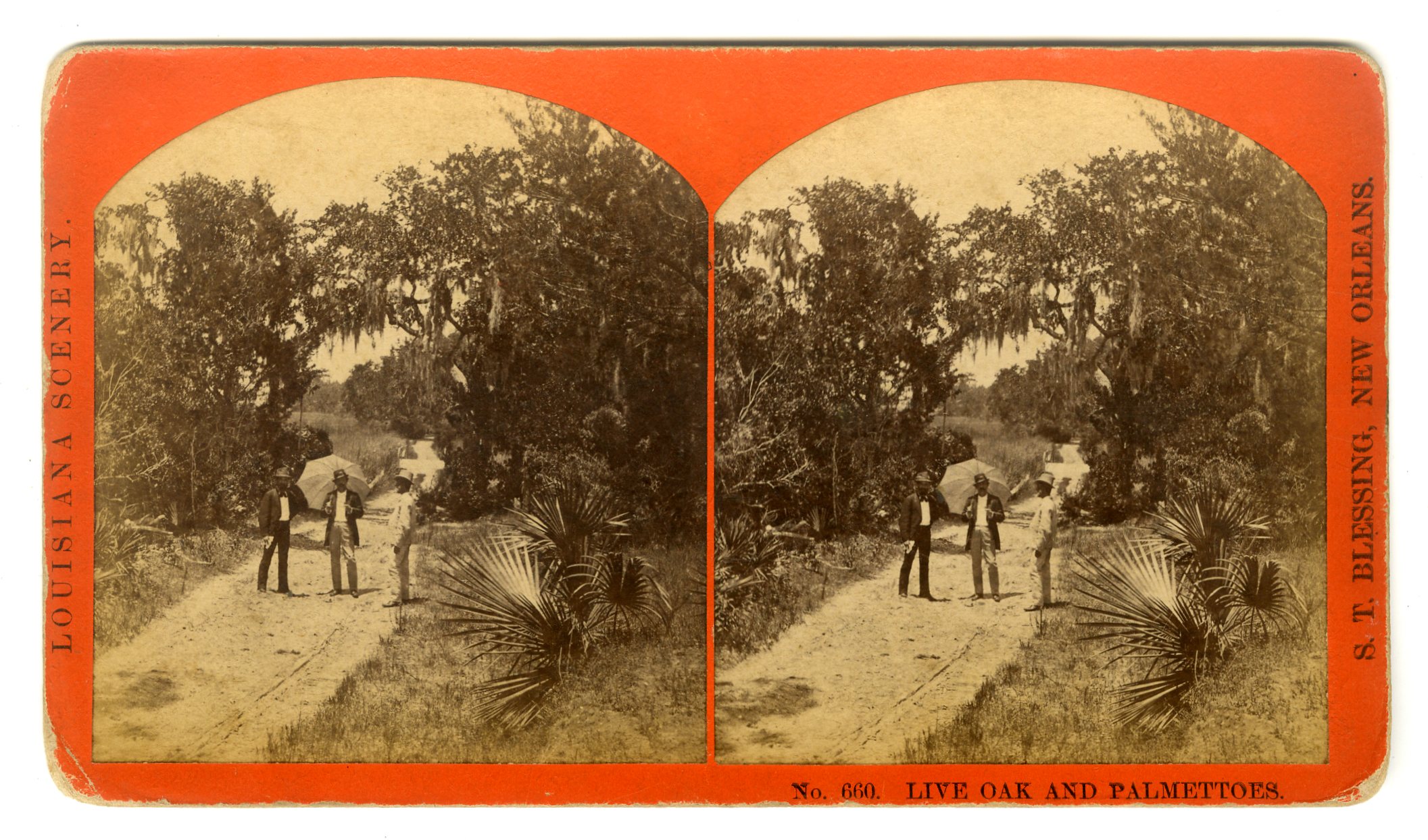
LOU141. S.T. Blessing, New Orleans. No. 660. Live Oak and Palmettoes. G. $75
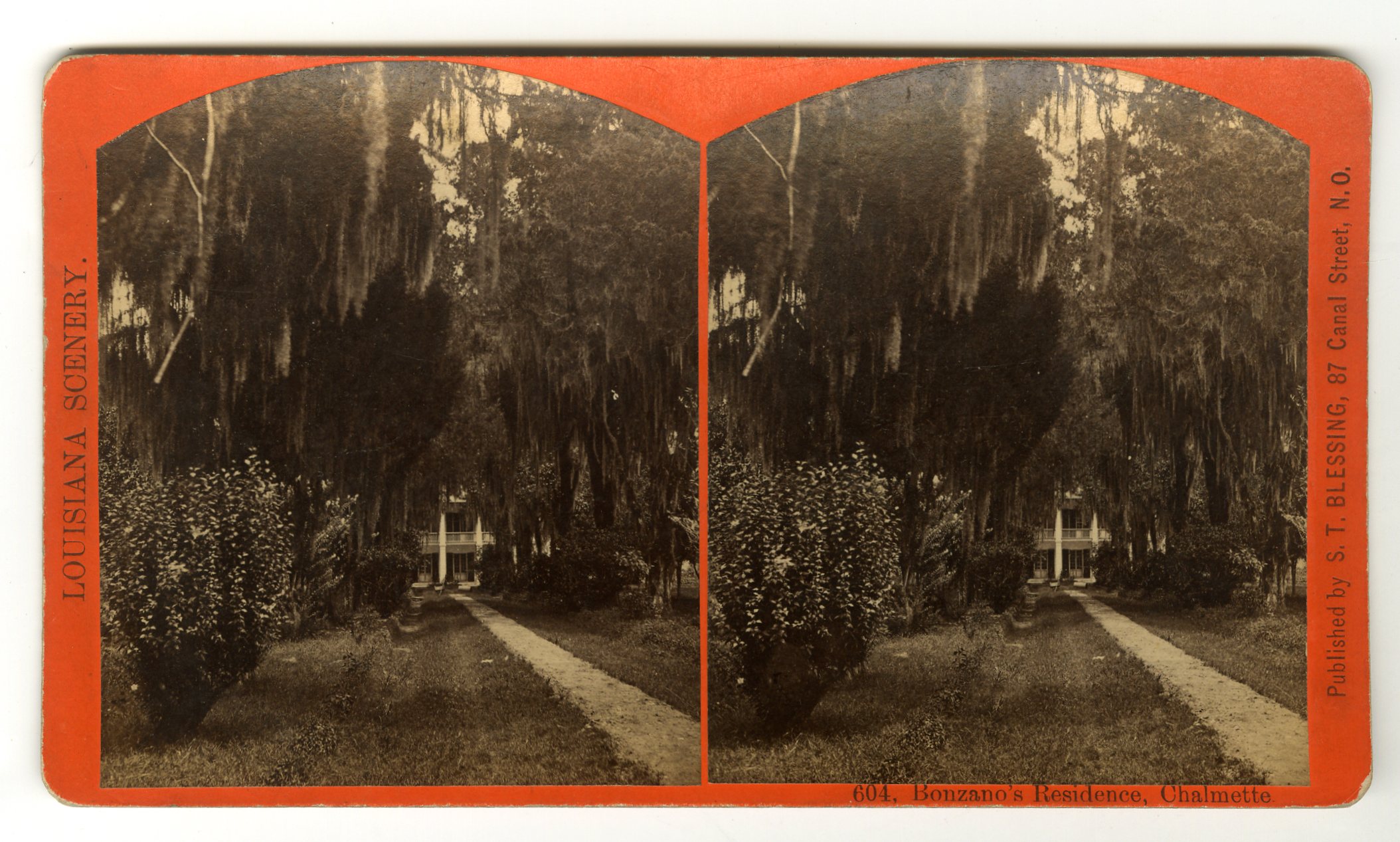
LOU142. S.T. Blessing, New Orleans. 604. Bonzano’s Residence, Chalmette. VG. $75
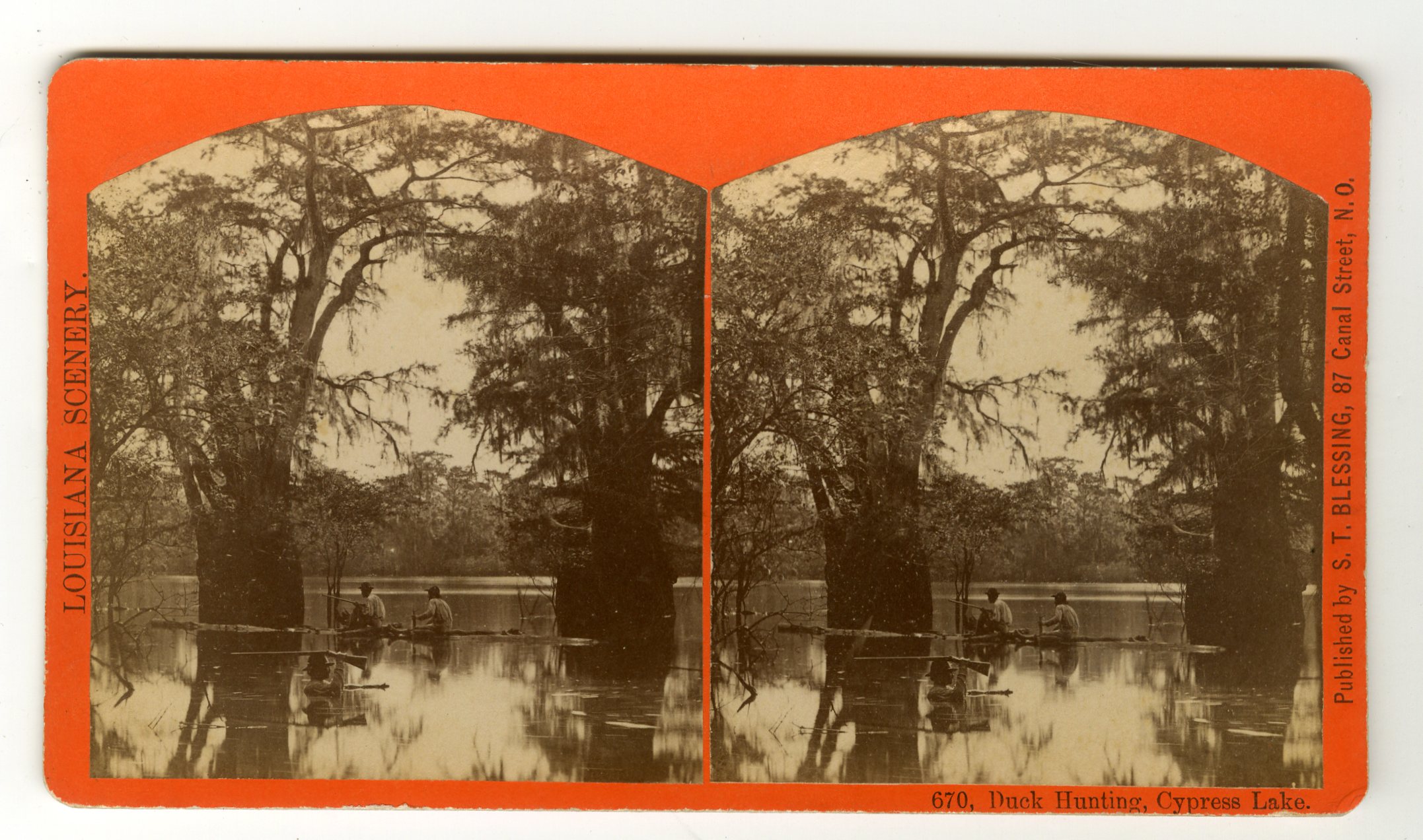
LOU143. S.T. Blessing, New Orleans. 670. Duck Hunting, Cypress Lake. VG. $100
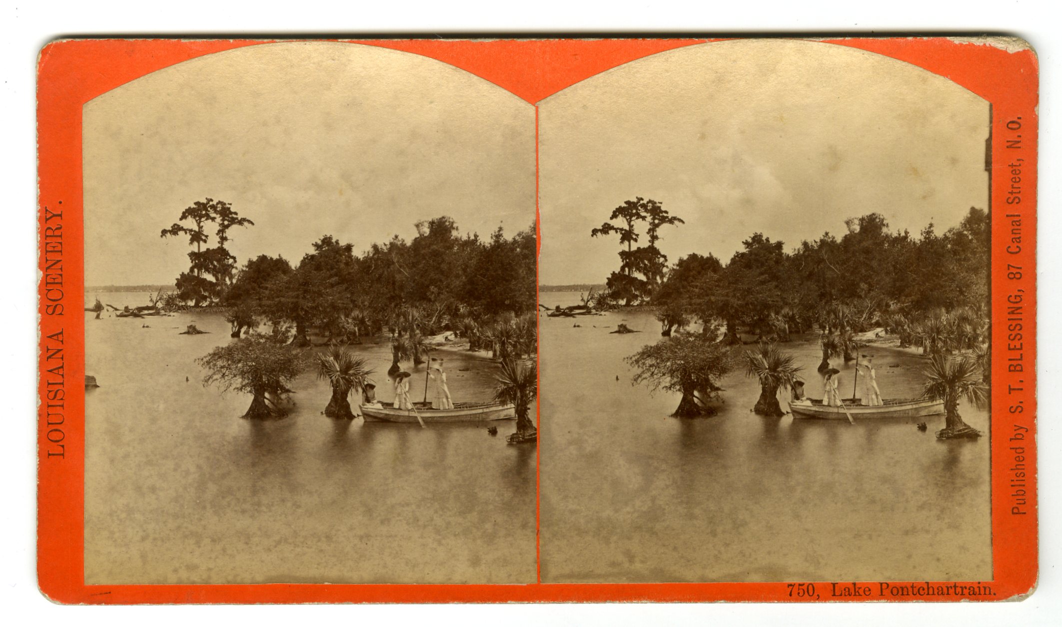
LOU145. S.T. Blessing, New Orleans. 750. Lake Pontchartrain. G. $85
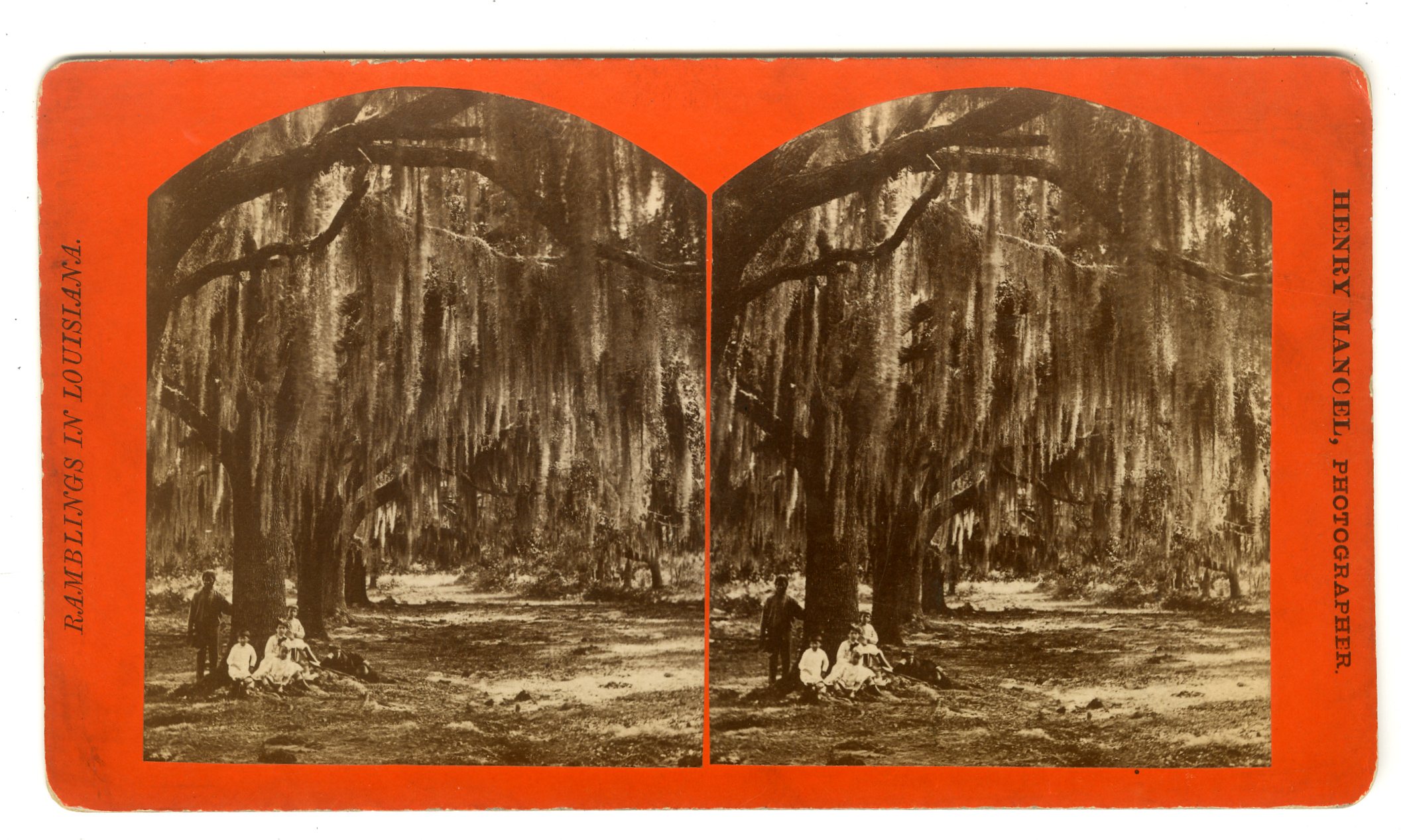
LOU146. Henry Mancel. Moss Trees. VG. $85
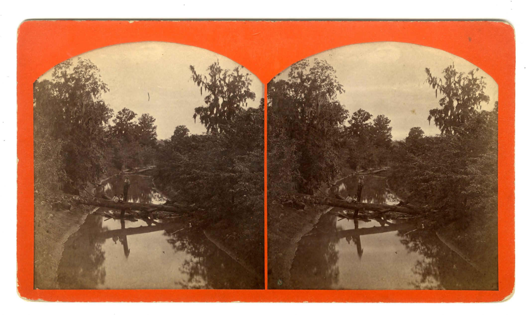
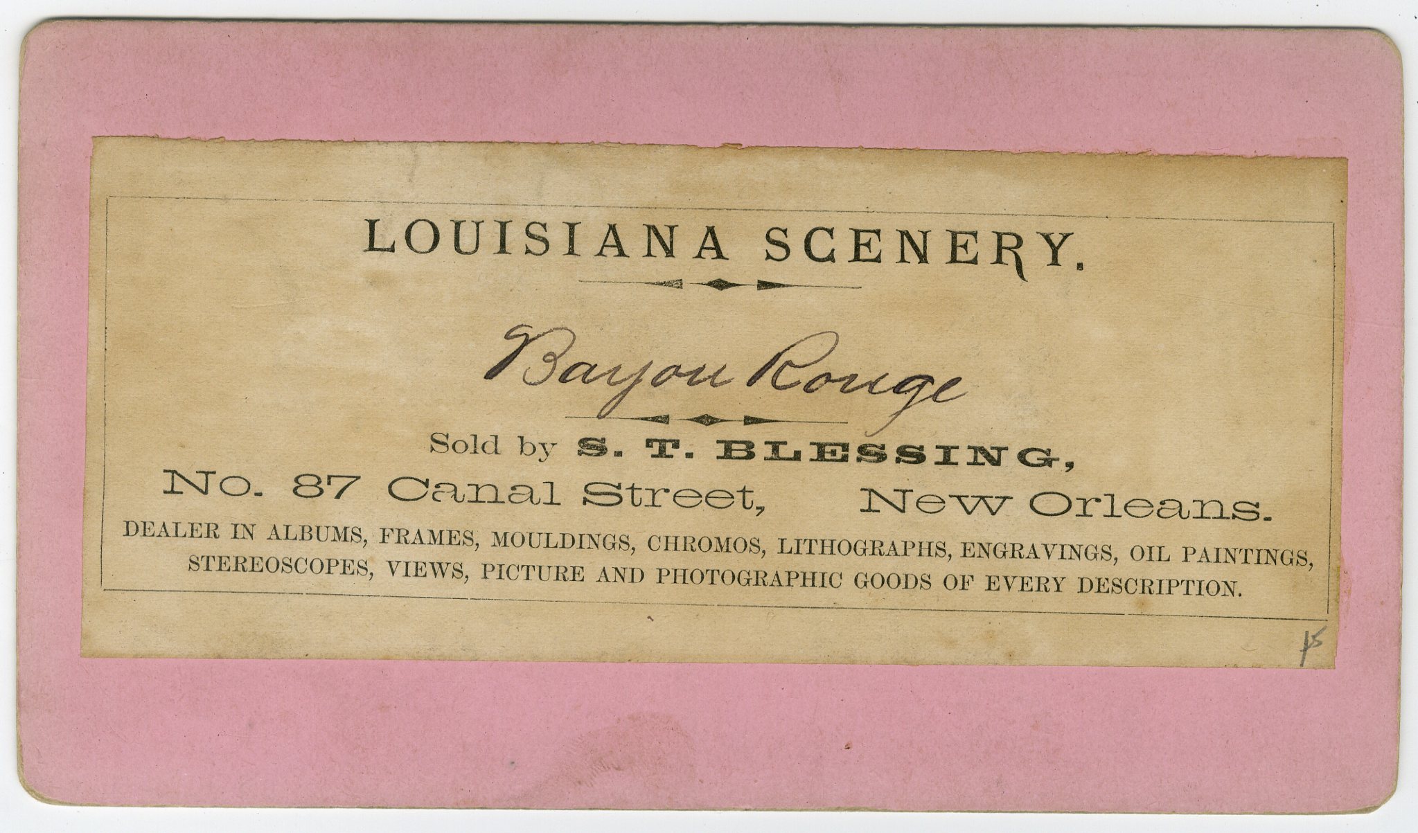
LOU148. S.T. Blessing, New Orleans. Bayou Rouge. G. $85
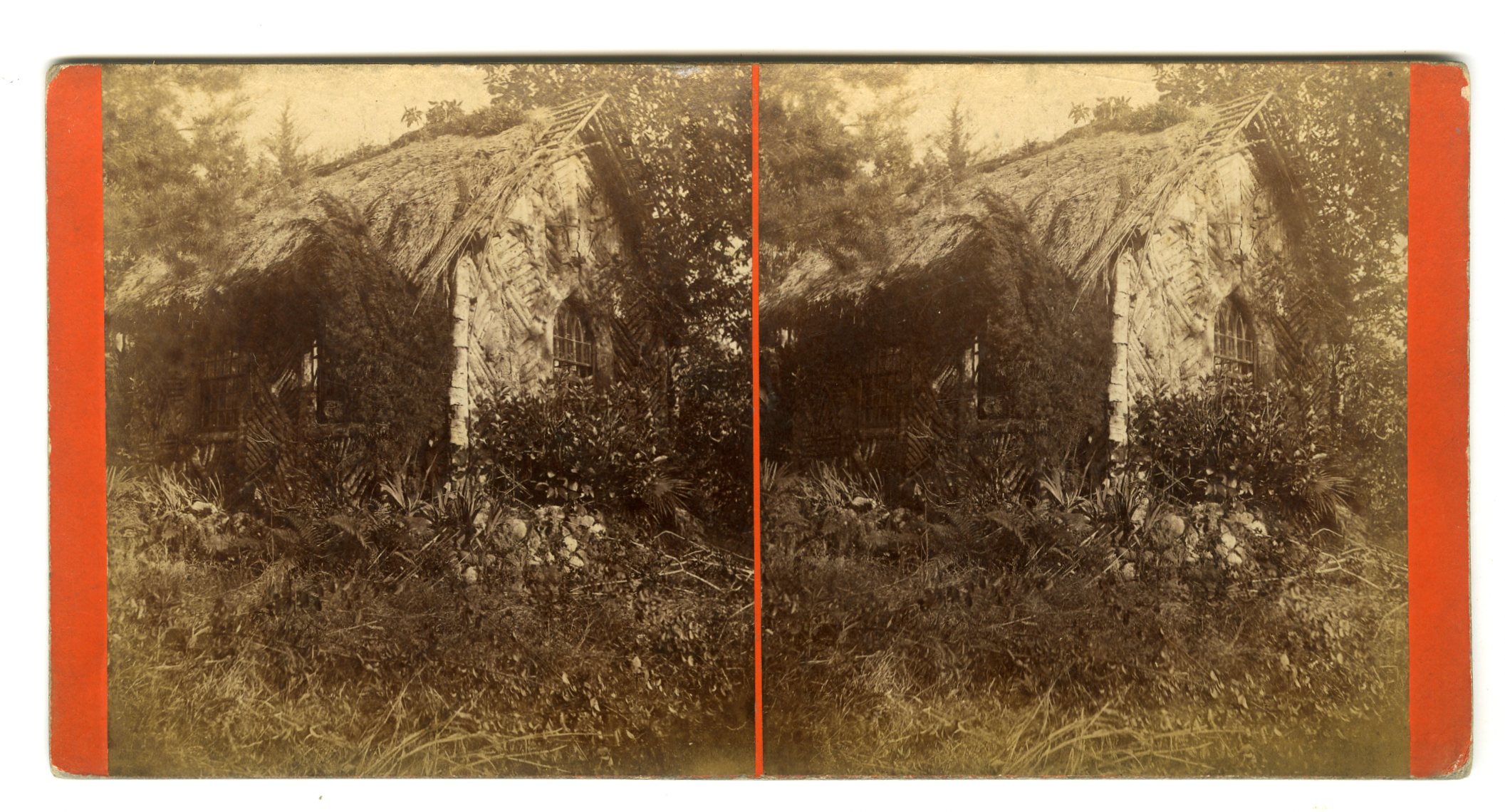
LOU149. S.T. Blessing, New Orleans. Indian Church. Card trimmed top and bottom. G. $75
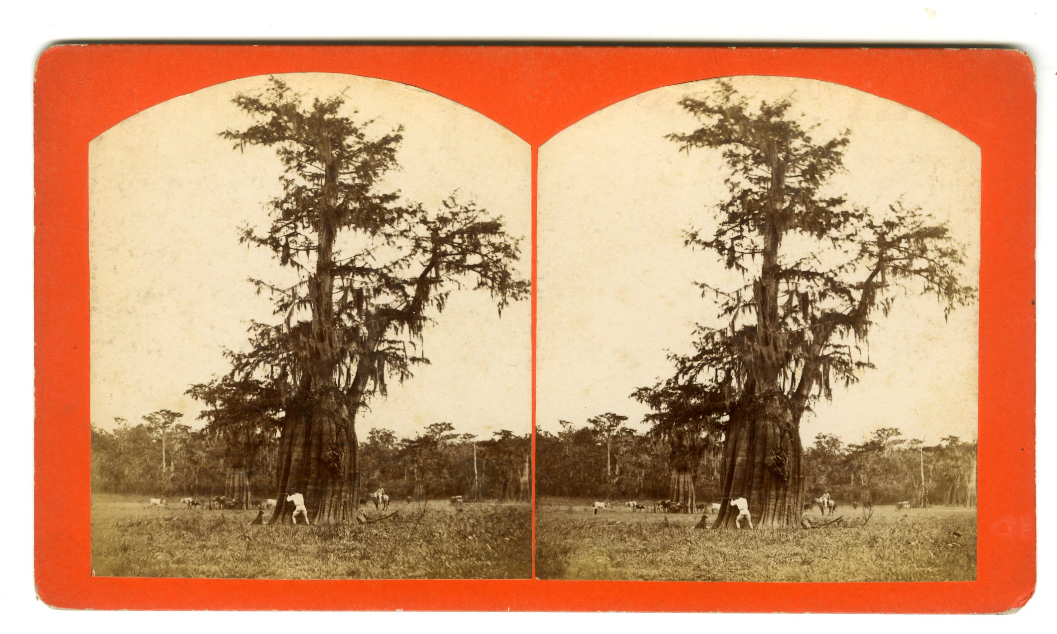
LOU150. S.T. Blessing, New Orleans. Grand Lake in Summer. Avery Ellis Parish. VG. $100
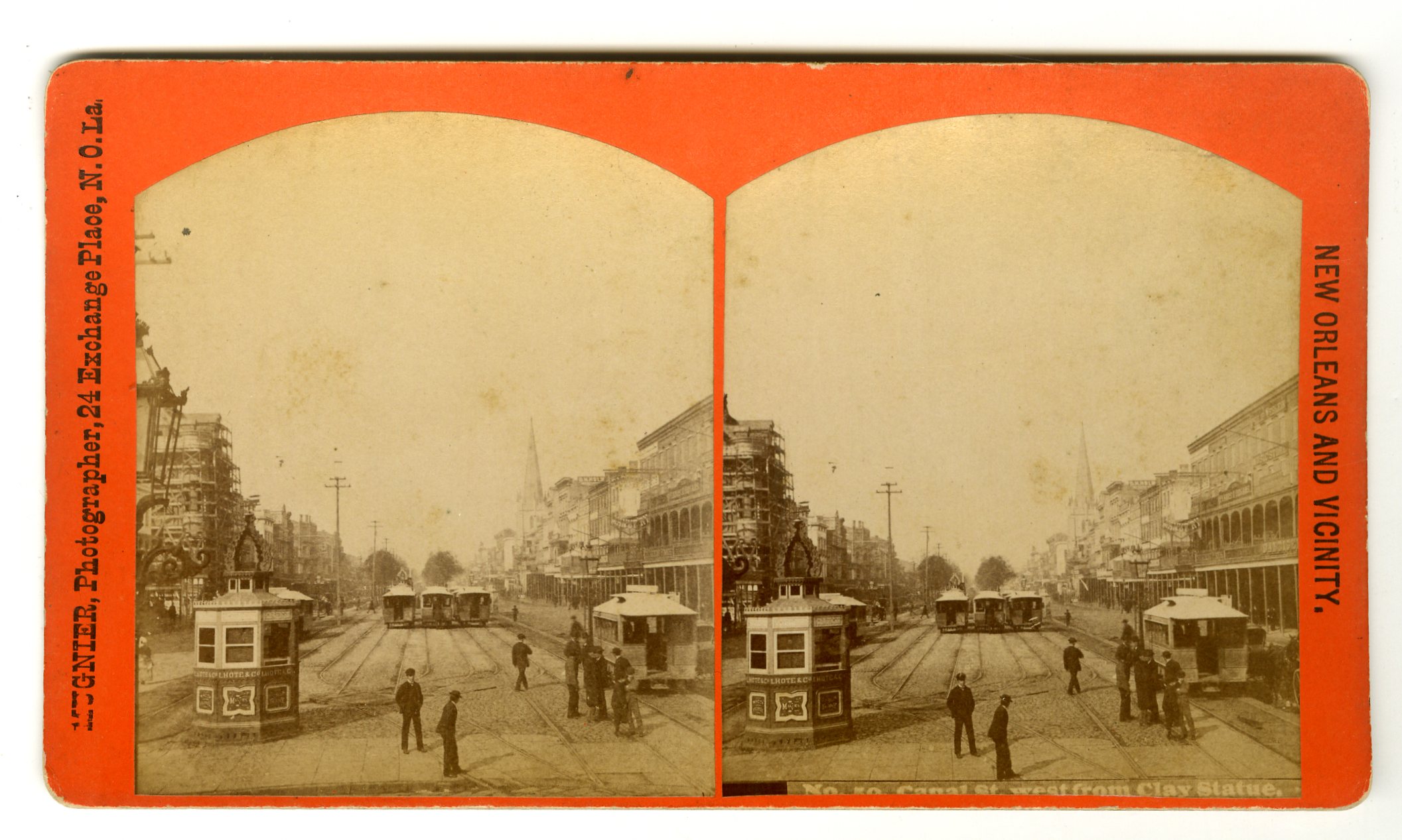
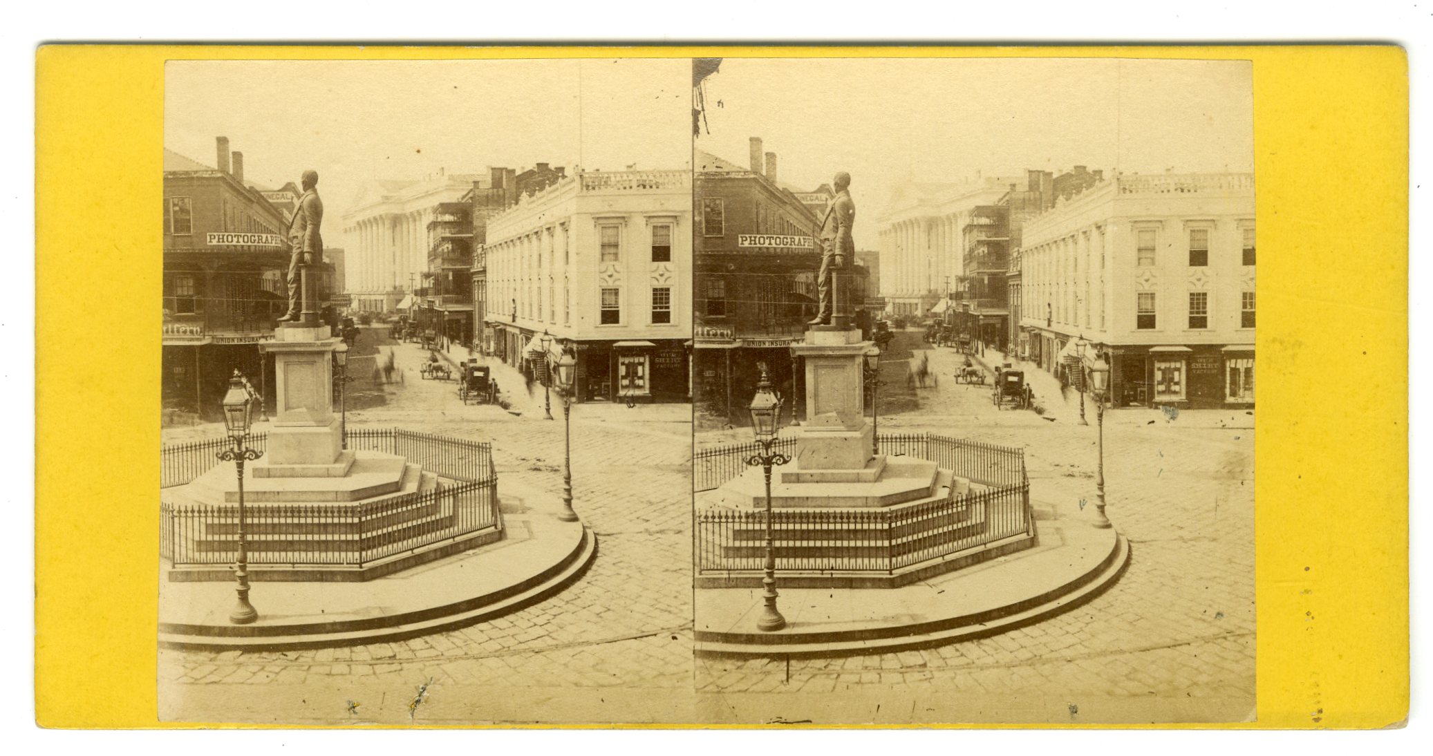
LOU151. Mugnier, New Orleans. No. 50. Canal St., west from Clay Statue. G. $100
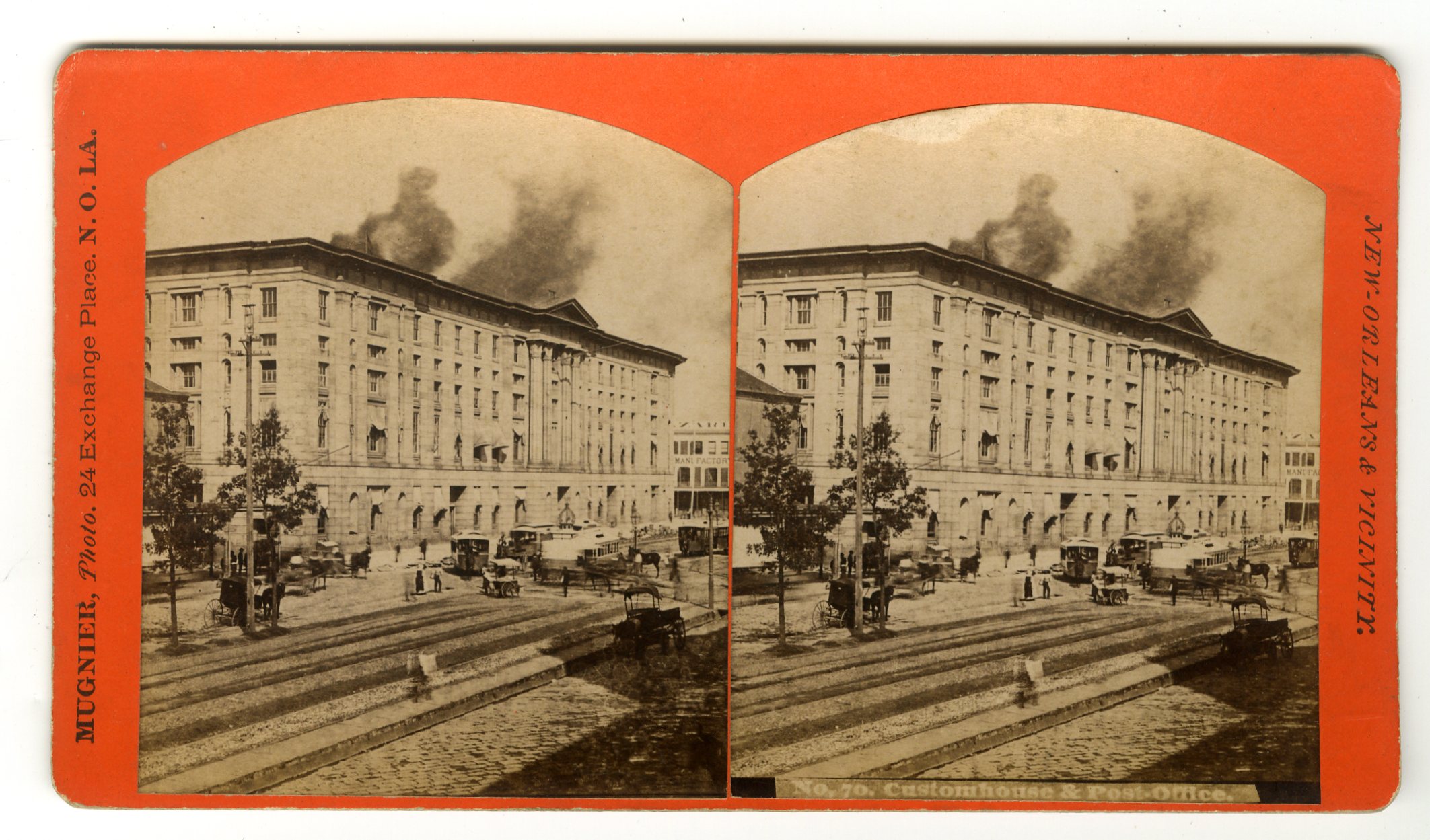
LOU152. Mugnier, New Orleans. No. 70. Custom House and Post Office. The smoke above is from the steamboats at the levee. VG. $125
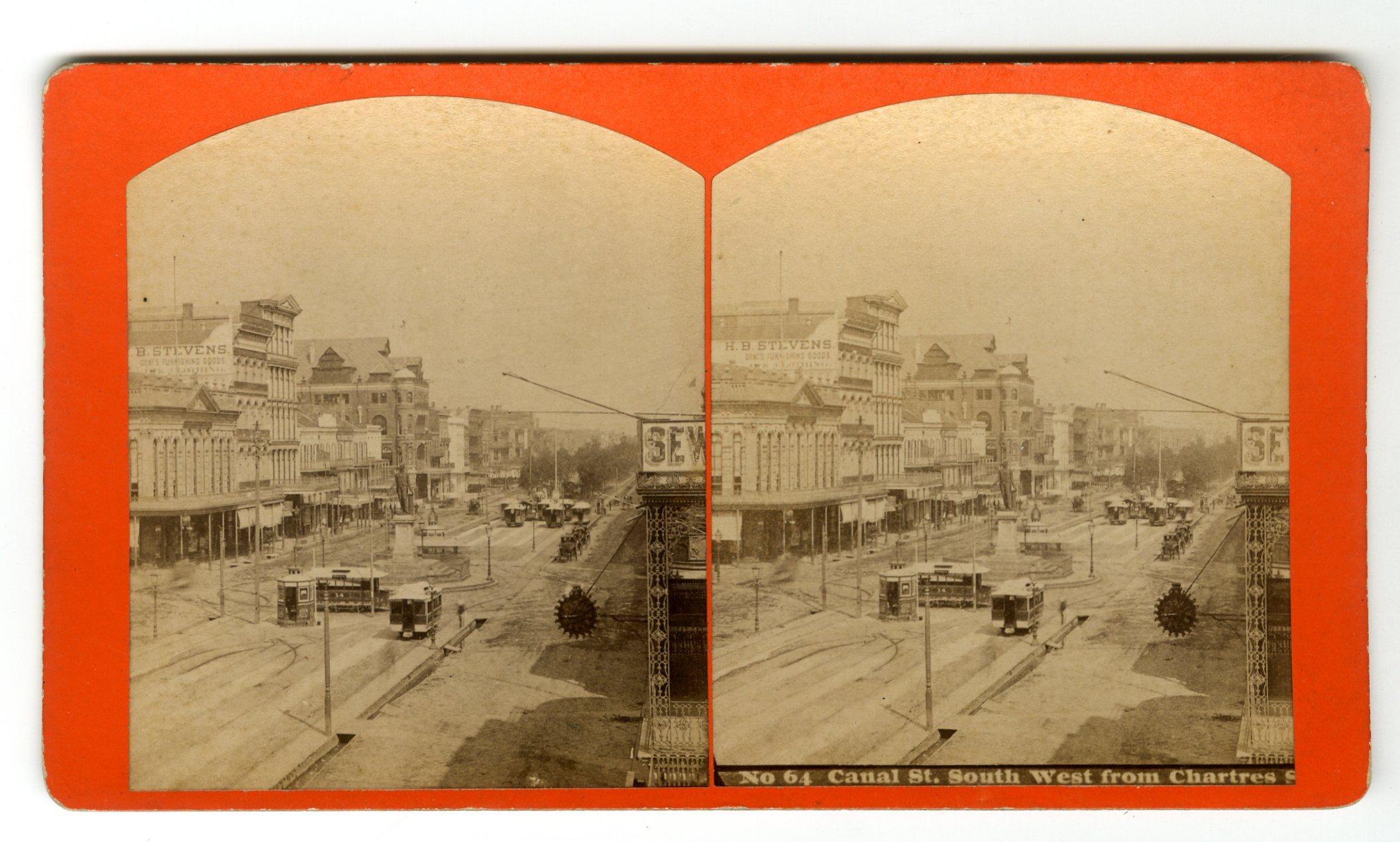
LOU153. [Mugnier, New Orleans.] No. 64. Canal St. South West from Chartres St. G. $85
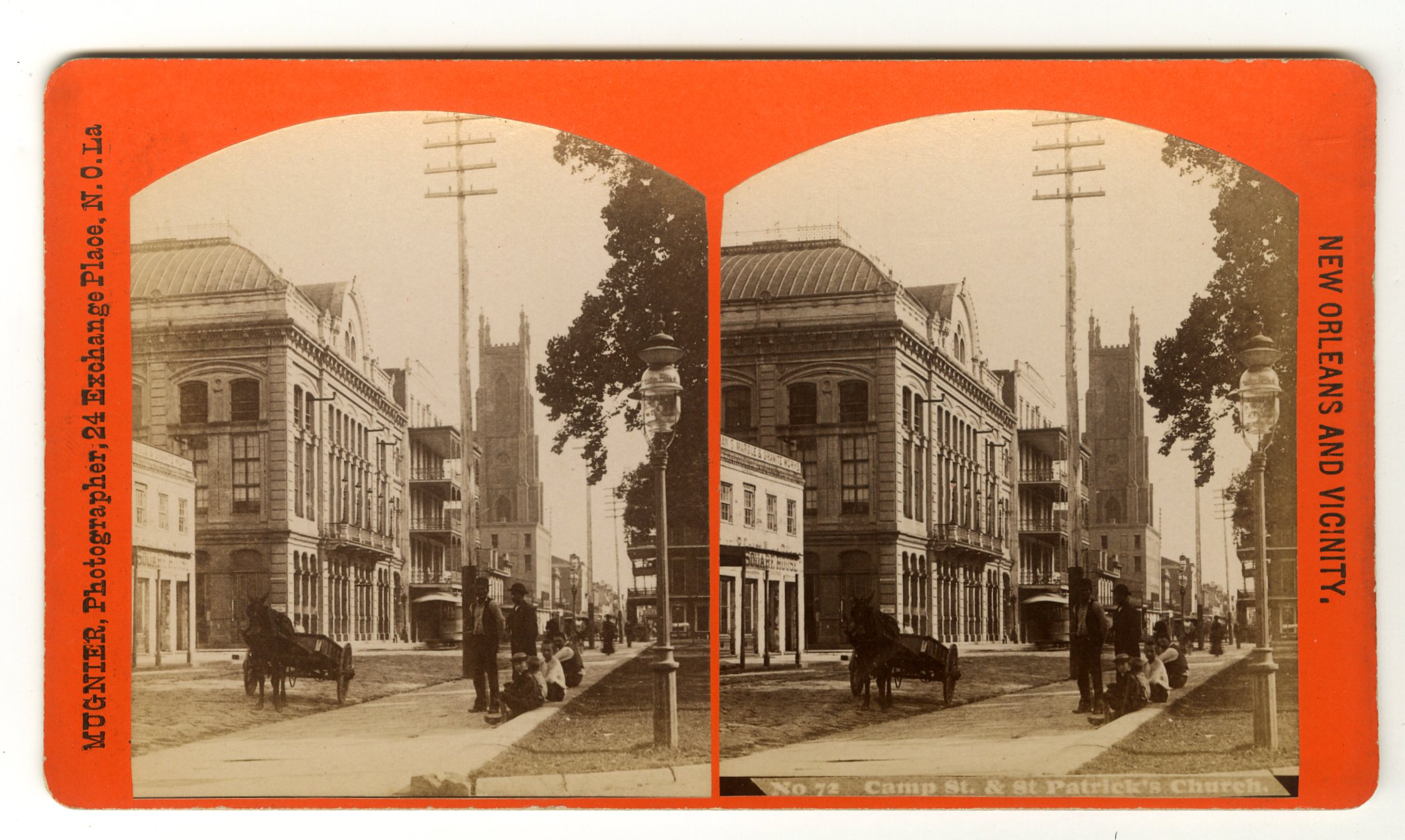
LOU155. Mugnier, New Orleans. No. 72. Camp St. & St. Patrick’s Church. VG. $125

LOU156. Mugnier, New Orleans. No. 385. Entrance of the Bazar, French Market. G. $150
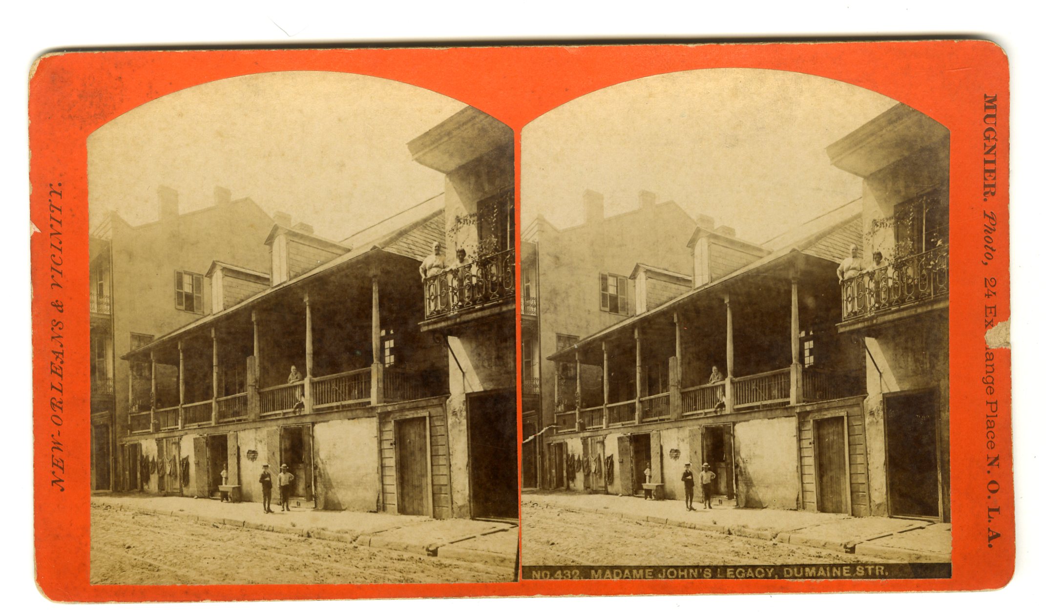
LOU157. Mugnier, New Orleans. No. 432. Madame John’s Legacy, Dumaine Str. Madame John’s Legacy is located in the historic French Quarter. It is one of the finest 18th-century building complexes in Louisiana and one of the best examples of French colonial architecture in North America. Built in 1788 following a devastating fire that destroyed eighty percent of the city, it was constructed in the French colonial style that prevailed before the disaster. Madame John’s is an excellent example of Louisiana-Creole 18th century residential design. Due to its fine architectural character and historical significance, it is an official National Historic Landmark. The complex consists of three buildings—the main house, a kitchen with cook’s quarters, and a two-story dependency. The house’s name was inspired by George Washington Cable’s 1874 short story “‘Tite Poulette,” in which the character Monsieur John bequeaths a Dumaine Street house to his mistress, known as Madame John. Though older parts of town were once dotted with similar structures, today very few houses like Madame John’s Legacy remain. G. $200
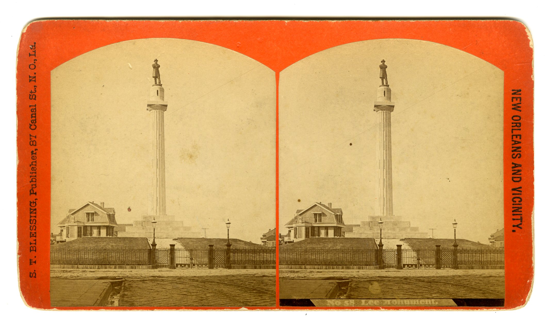
LOU159. S.T. Blessing, New Orleans. No. 58. Lee Monument. The Robert E. Lee Monument formerly in New Orleans is a historic statue dedicated to Confederate General Robert E. Lee by noted American sculptor Alexander Doyle. It was removed (intact) by official order and moved to an unknown location on May 19, 2017. Any future display is uncertain.
Efforts to raise funds to build the statue began after Lee’s death in 1870 by the Robert E. Lee Monument Association, which by 1876 had raised the $36,400 needed. The association’s president was Louisiana Supreme Court Justice Charles E. Fenner. New York sculptor Alexander Doyle was hired to sculpt the brass statue, which was installed in 1884. The granite base and pedestal was designed and built by John Ray [Roy], architect; contract dated 1877, at a cost of $26,474. John Hagan, a builder, was contracted to “furnish and set” the column at a cost of $9,350. The monument was dedicated in 1884, at Tivoli Circle (since commonly called Lee Circle) on St. Charles Avenue. Dignitaries present at the dedication on February 22—George Washington’s birthday—included former Confederate President Jefferson Davis, two daughters of General Lee, and Confederate General P.G.T. Beauregard. The statue itself rises 16’6″ tall, with an 8’4″ base, standing on a 60′ column with an interior staircase, according to a schematic released by the City of New Orleans on the day of the removal of the statue and its base, May 19, 2017. The Lee statue faced “north where, as local lore has it, he can always look in the direction of his military adversaries.” In January 1953, the statue of General Lee was lifted from atop the column for repairs to the monument’s foundation. The statue was returned to its perch in January the following year. A racial confrontation occurred at the monument on January 19, 1972, the birthday of Confederate General Robert E. Lee, when Addison Roswell Thompson, a perennial segregationist candidate for governor of Louisiana and mayor of New Orleans, and his friend and mentor, Rene LaCoste (not to be confused with the French tennis player René Lacoste), clashed with a group of Black Panthers. Then eighty-nine years of age and a former opera performer in New York City, LaCoste was described as “dapper in seersucker slacks and navy sports jacket” and with a “white mustache and goatee” resembling Colonel Sanders of Kentucky Fried Chicken. LaCoste and Thompson dressed in Klan robes for the occasion and placed a Confederate flag at the monument. The Black Panthers began throwing bricks at the pair, but police arrived in time to prevent serious injury. At the time of the Thompson/LaCoste confrontation, David Duke, then an active Klansman who served from 1989 to 1992 in the Louisiana House of Representatives, had been among those jailed in New Orleans for “inciting to riot.” G. $85
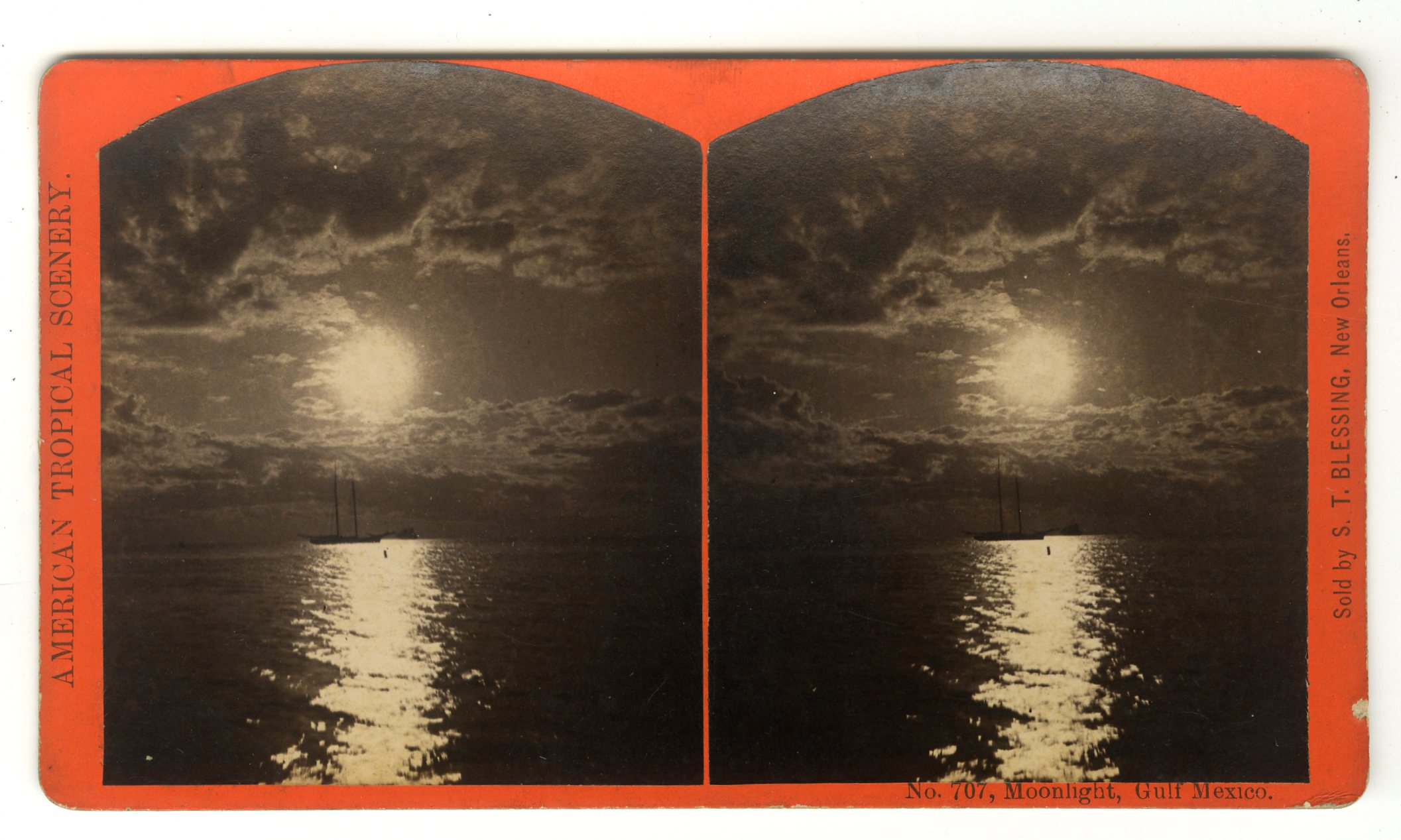
LOU160. S.T. Blessing, New Orleans. No. 707. Moonlight, Gulf of Mexico. VG. $75
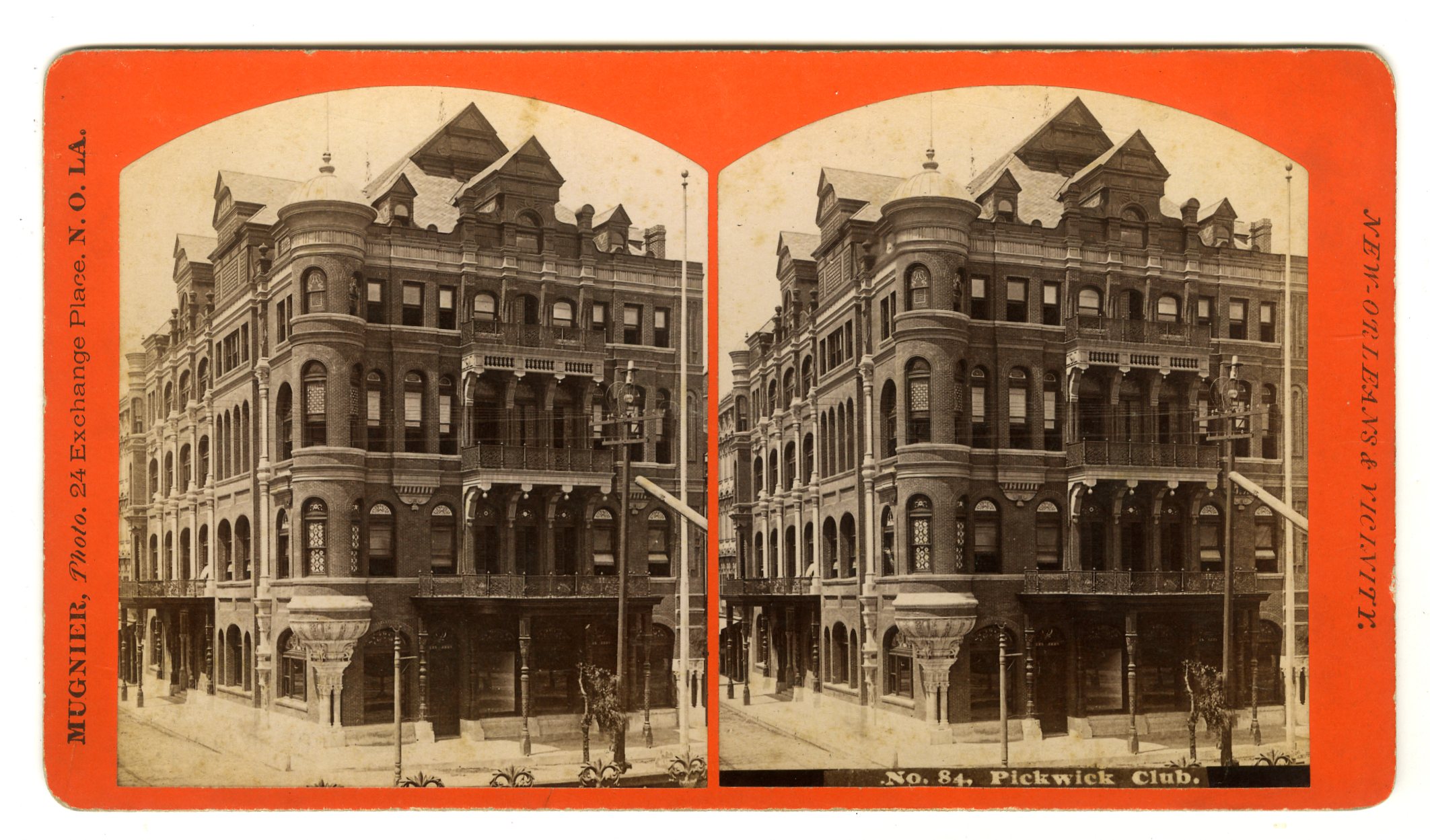
LOU162. Mugnier, New Orleans. No. 84. Pickwick Club. VG. $100
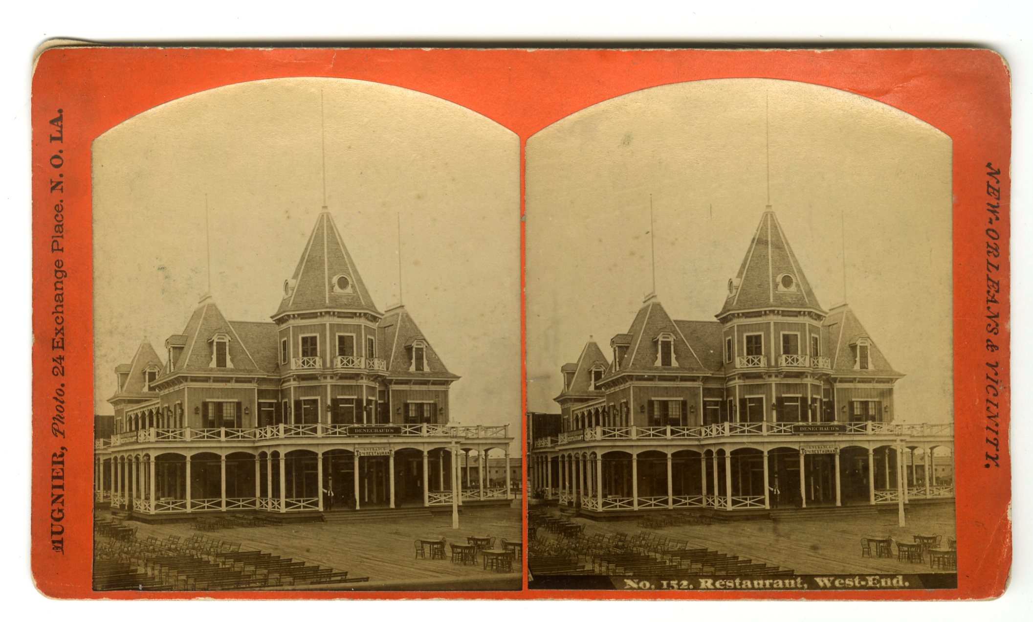
LOU163. Mugnier, New Orleans. No. 152. Restaurant, West-End. G. $75

LOU164. S.T. Blessing, New Orleans. No. 140. Moresque Building. Cast iron building. VG. $100
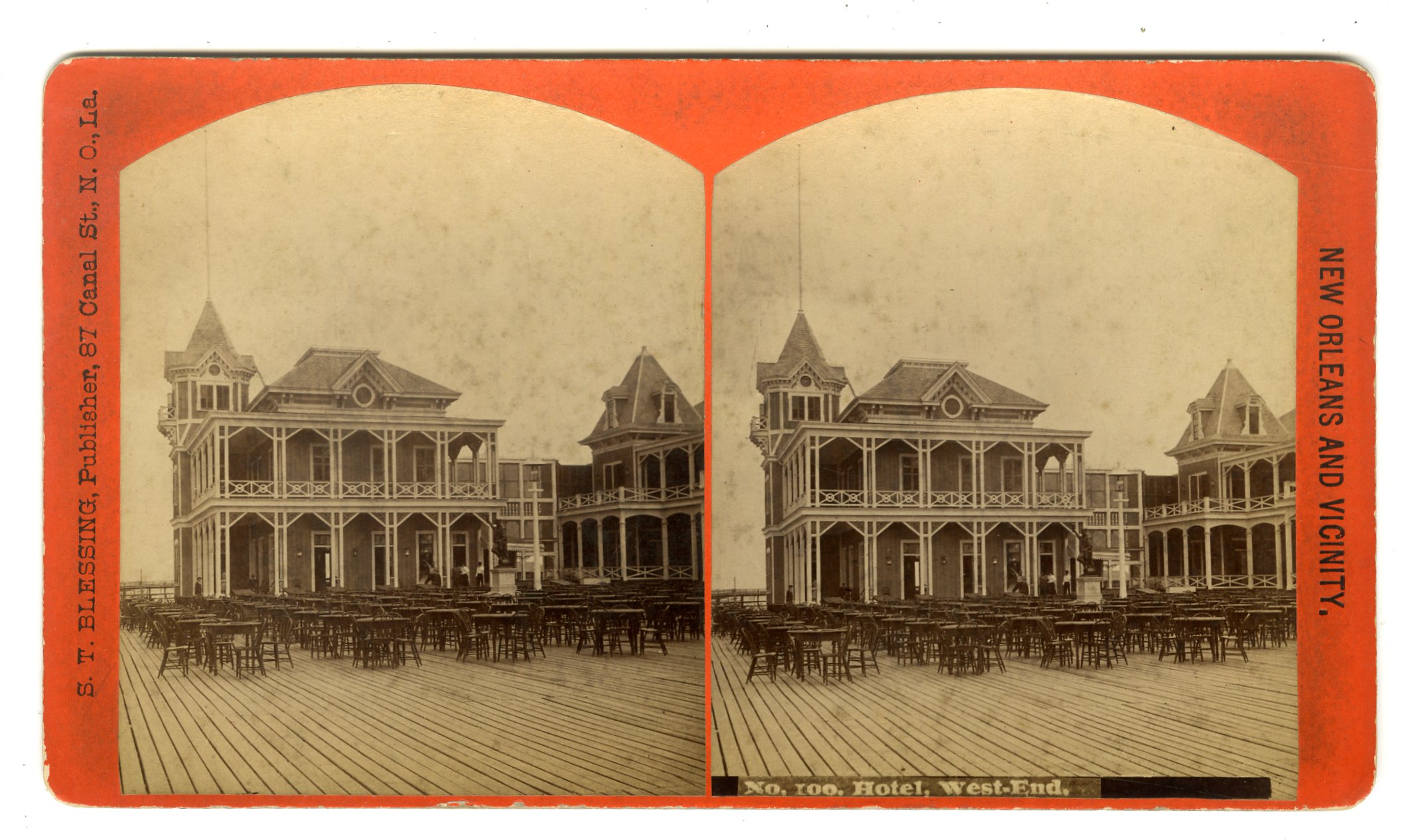
LOU170. S.T. Blessing, New Orleans. No. 100. Hotel, West-End. G. $65
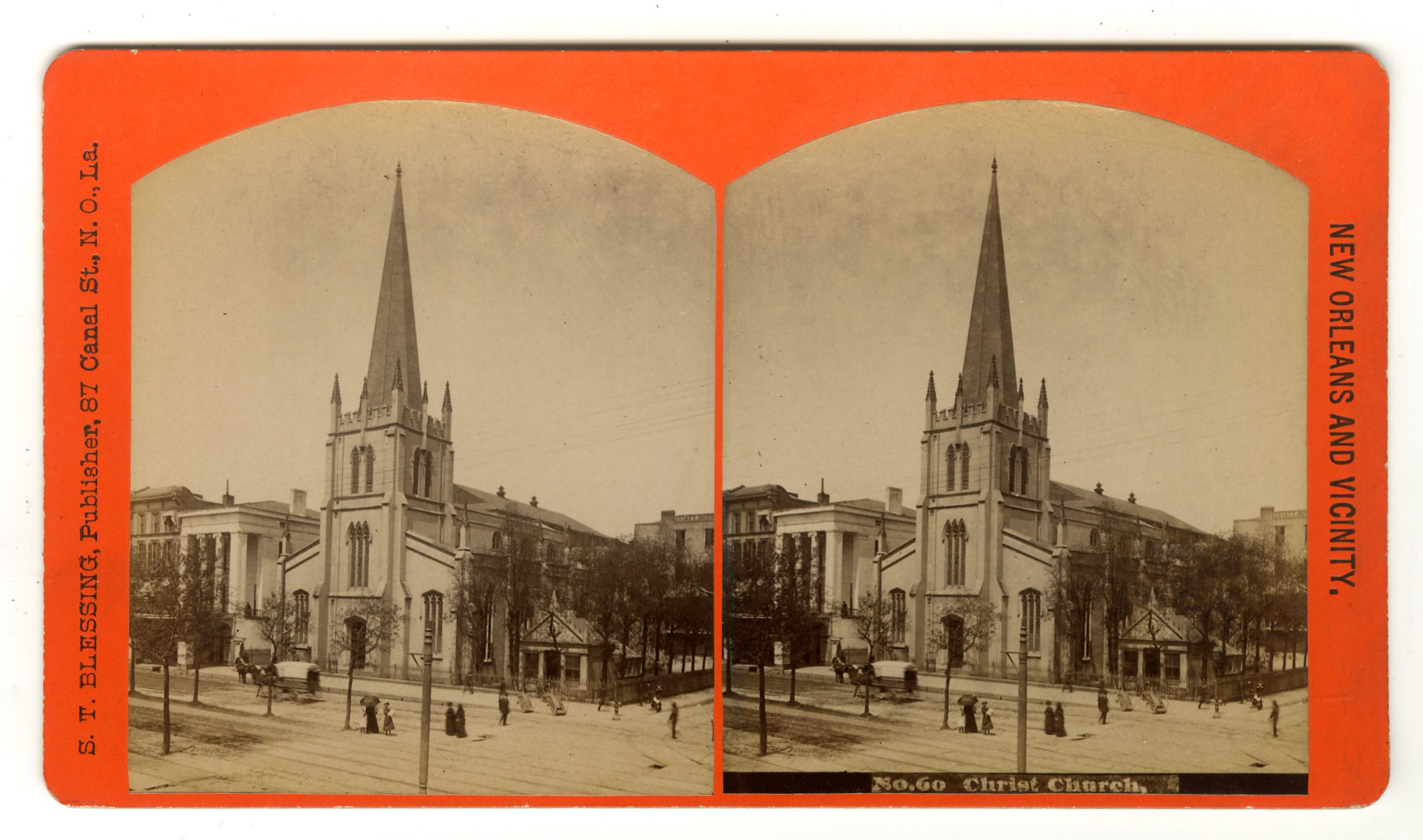
LOU172. S.T. Blessing, New Orleans. No. 60. Christ Church. G. $65
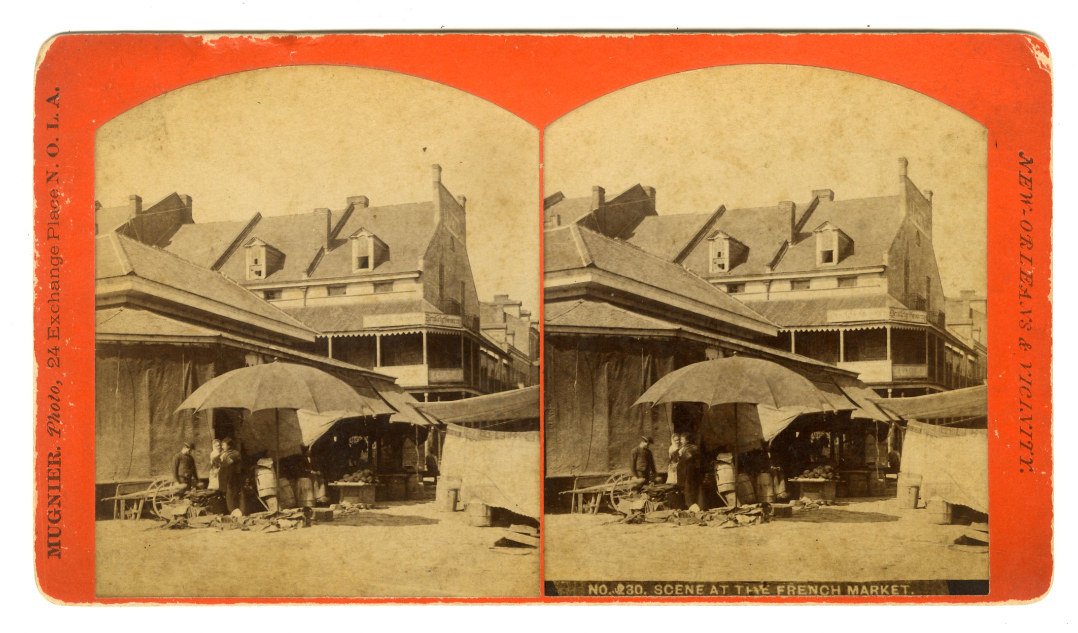
LOU174. Mugnier, New Orleans. No. 230. Scene at the French Market. G. $175
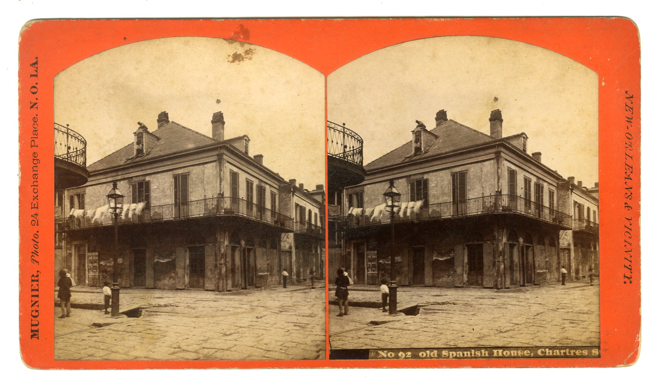
LOU175. Mugnier, New Orleans. No. 92. Old Spanish House, Chartres St. G. $175
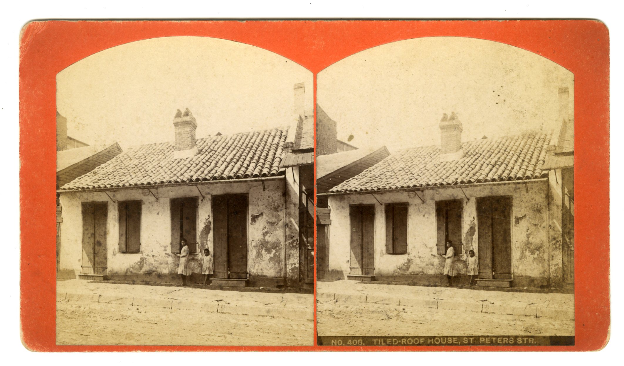
LOU176. [S.T. Blessing, New Orleans]. No. 408. Tiled-Roof House, St. Peters Str. G. $200
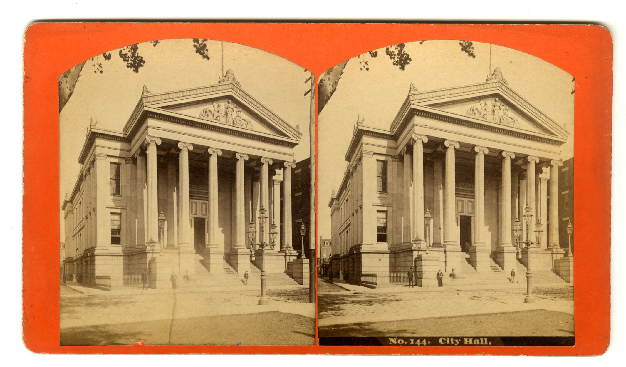
LOU177. [S.T. Blessing, New Orleans]. No. 144. City Hall. G. 475
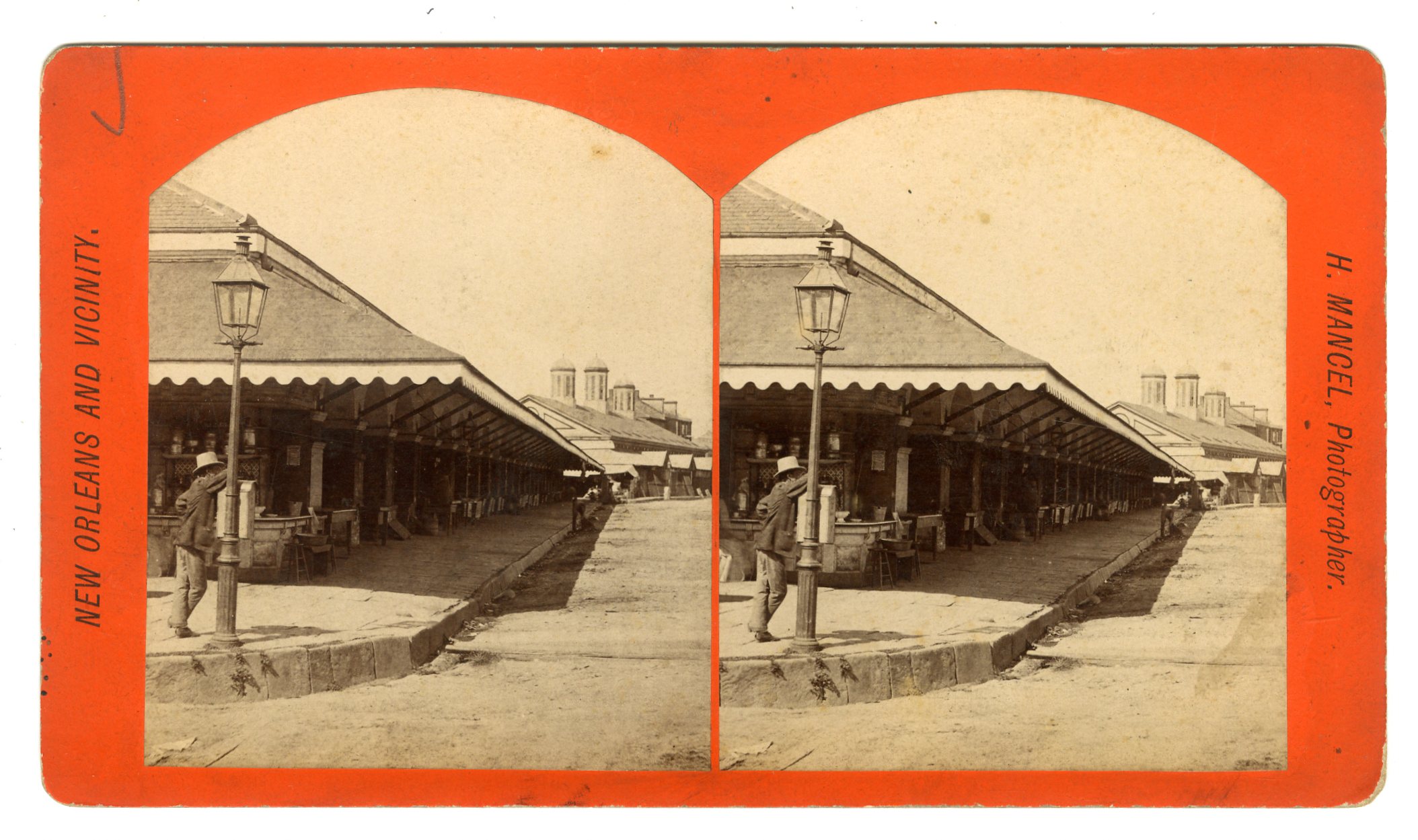
LOU178. H. Mancel. French Market. G. $100

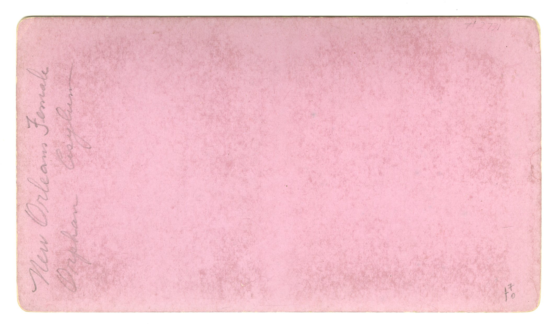
LOU179. Mugnier, New Orleans. No. 79. Margaret’s Place. New Orleans Female Orphan Asylum. G. $125

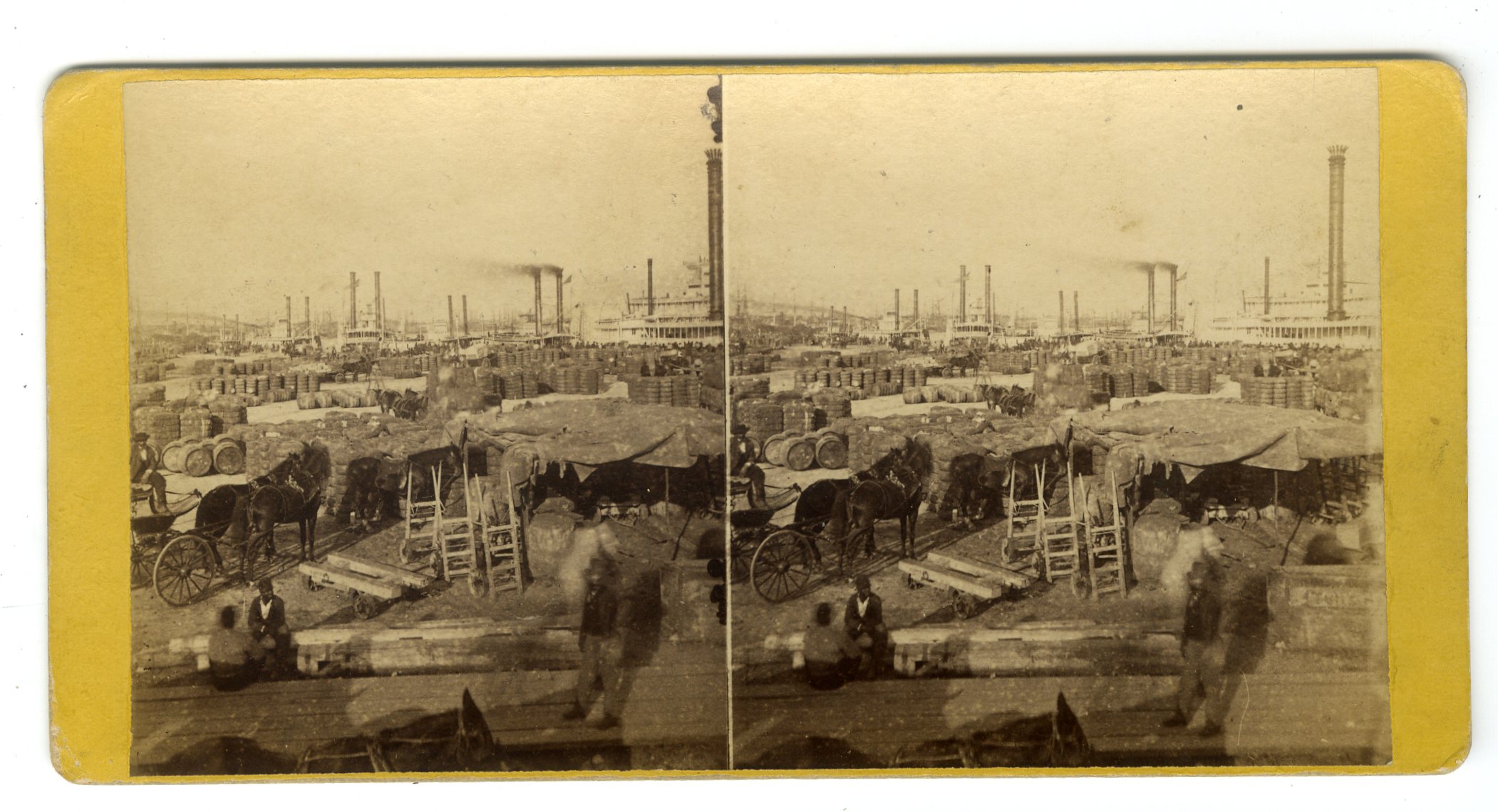
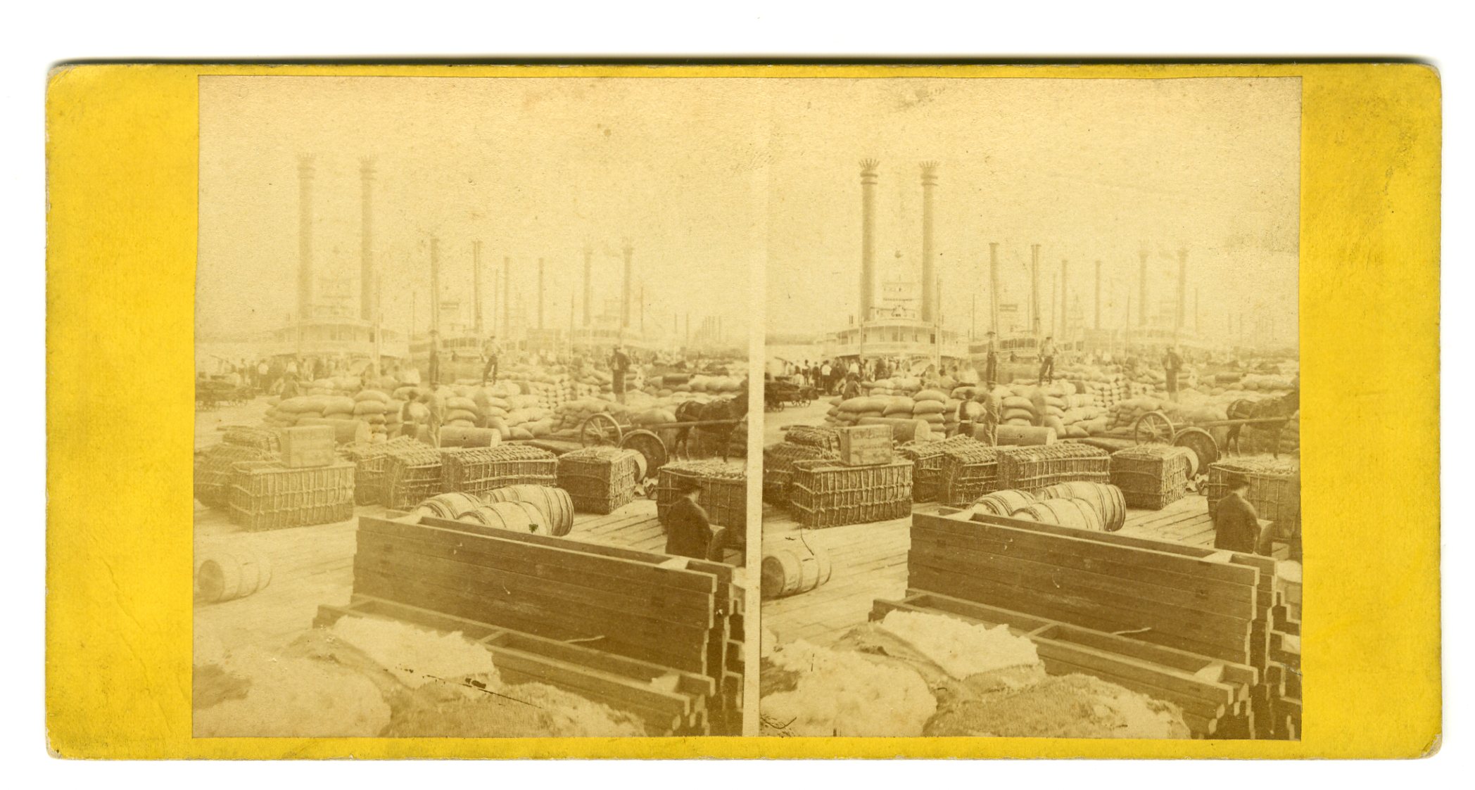
LOU180. S.T. Blessing, New Orleans. No. 210. View Cotton Levee. G. $75
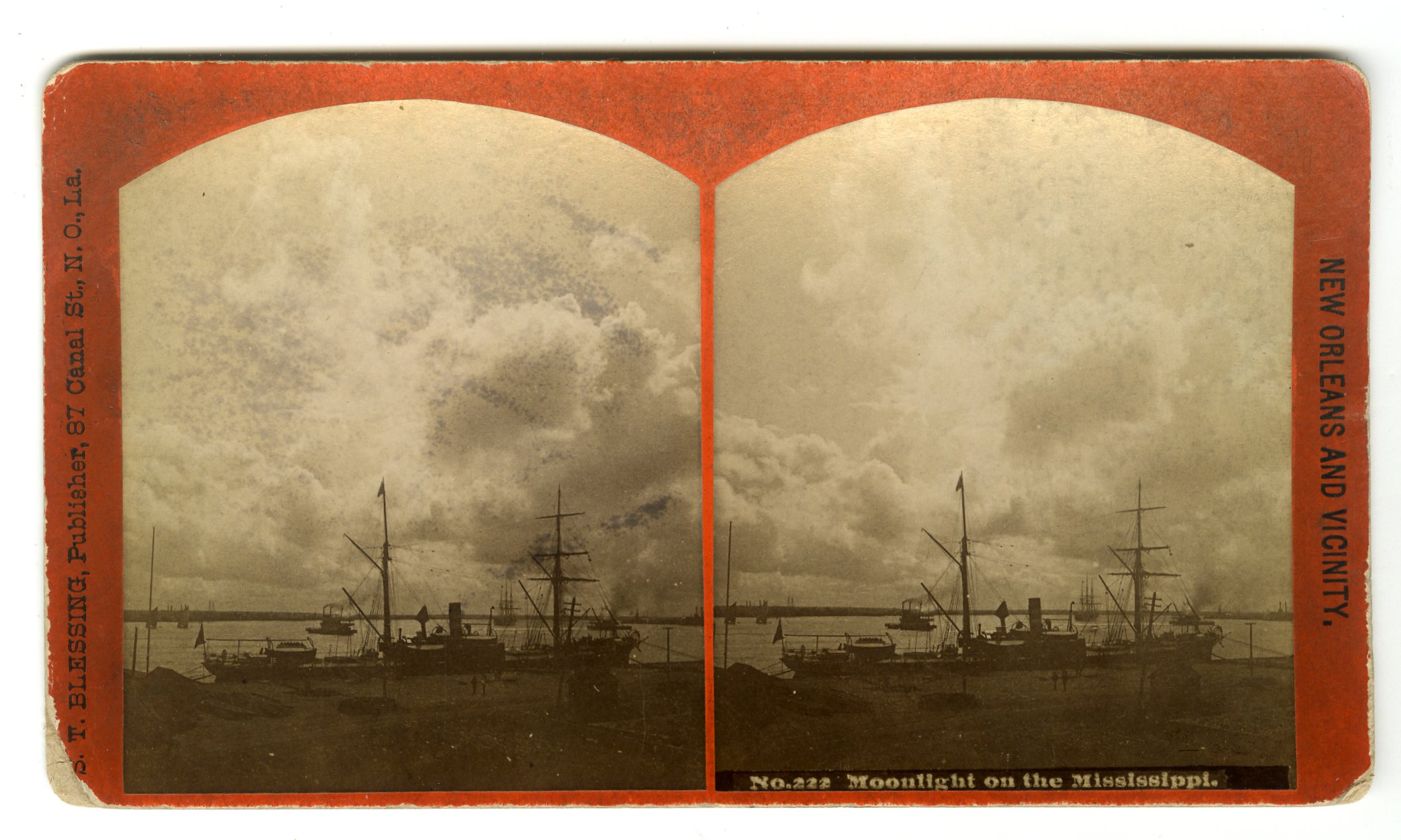
LOU181. S.T. Blessing, New Orleans. No. 222. Moonlight on the Mississippi. G. $75
![]()
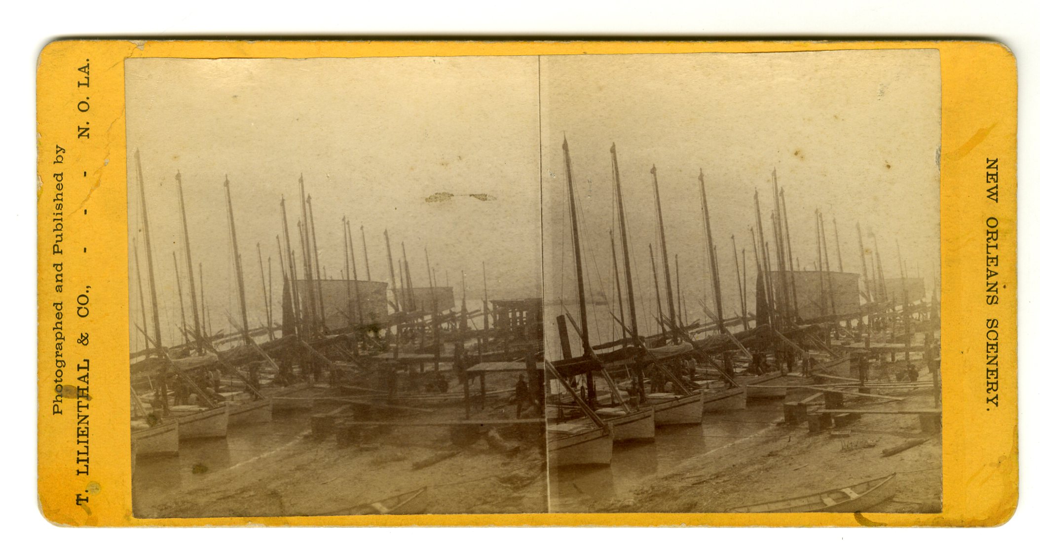
LOU183. Theo. Lilienthal, New Orleans. Steamboat Levee. G. $75
![]()
LOU184. Lilienthal & Co., New Orleans. Levee opposite French Market. G. $75

![]()
LOU185. Theo. Lilienthal, New Orleans. 30. Levee and Upper Landing. G. $75
![]()
LOU186. Theo. Lilienthal, New Orleans. 31. Levee and Steamship Landing. G. $75

![]()
LOU188. Theo. Lilienthal, New Orleans. Interior of Steamer Frank Pargoud. This sidewheel, wooden hull packet was built in 1868 by Howard & Co., Jeffersonville, Indiana. The FRANK PARGOUD was built for John W. Tobin, of New Orleans, who was the sole owner, and it was named for Gen. Frank Pargoud, a wealthy Ouachita River planter. Originally designed for the New Orleans-Ouachita River trade, she proved too large and was placed on the New Orleans-St.Louis trade, running several trips. She subsequently ran between New Orleans-Memphis, making weekly round trips, which was an achievement for a regular packet. Later, she was moved to the New Orleans-Vicksburg trade, running two trips per week, before running steadily in the New Orleans-Fort Adams trade. G. $75
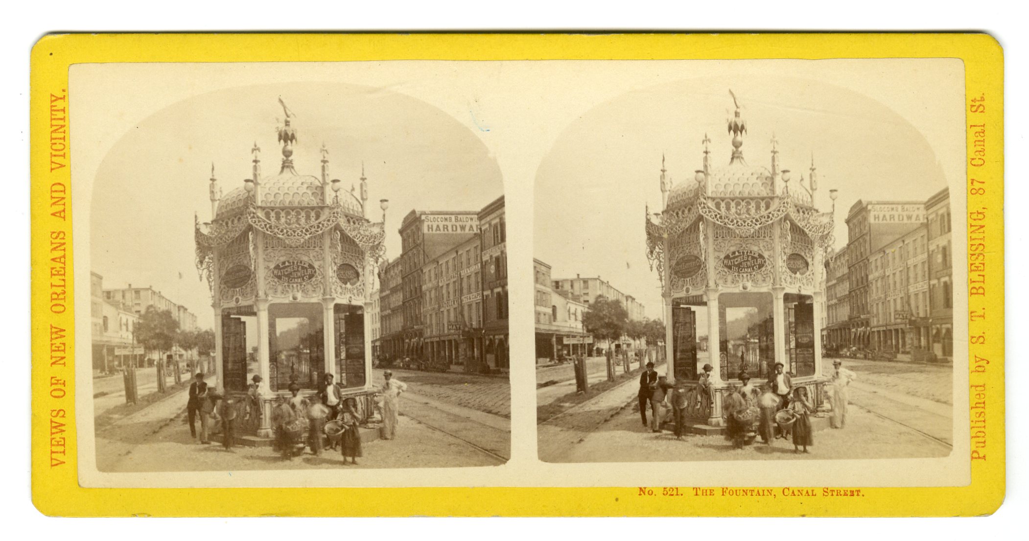
LOU196. S.T. Blessing, New Orleans. No. 521. The Fountain, Canal Street. E. $200
![]()
LOU197. Theo. Lilienthal, New Orleans. 45. Charles Street, Showing Masonic Hall. Other signs visible on street such as “Gun Store.” E. $200
![]()
LOU198. Theo. Lilienthal, New Orleans. 101. Clay Statue, Crescent Billiard Saloon and St. Charles Hotel. “Photographs” sign to the left of Clay. VG. $150
![]()
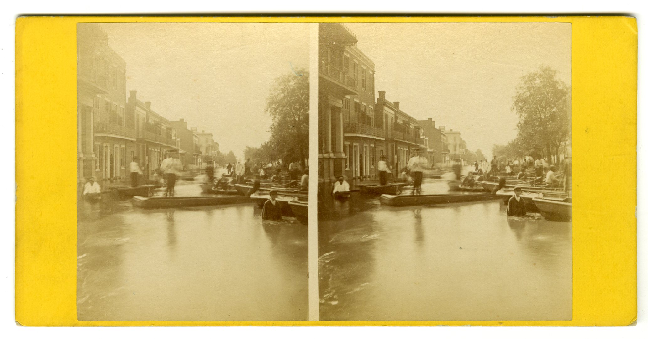
LOU199. Theo. Lilienthal, New Orleans. 104. Flood in July 1871, Claiborne Street. VG. $150
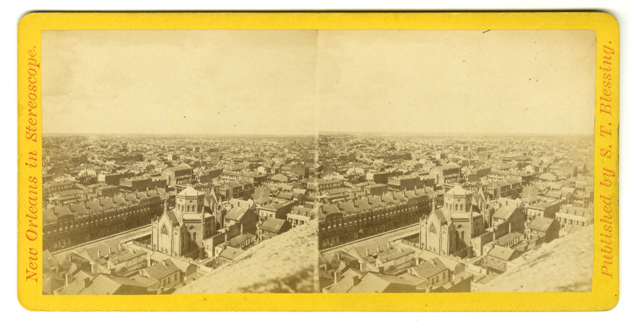

LOU200. S.T. Blessing, New Orleans. No. 411. Bird’s-eye Panoramic View, No. 2. Taken from St. Patrick’s Church Spire, looking South-West. VG. $150
![]()
LOU201. Theo. Lilienthal, New Orleans. 14. U.S. Customhouse, Canal Street. VG. $100
![]()
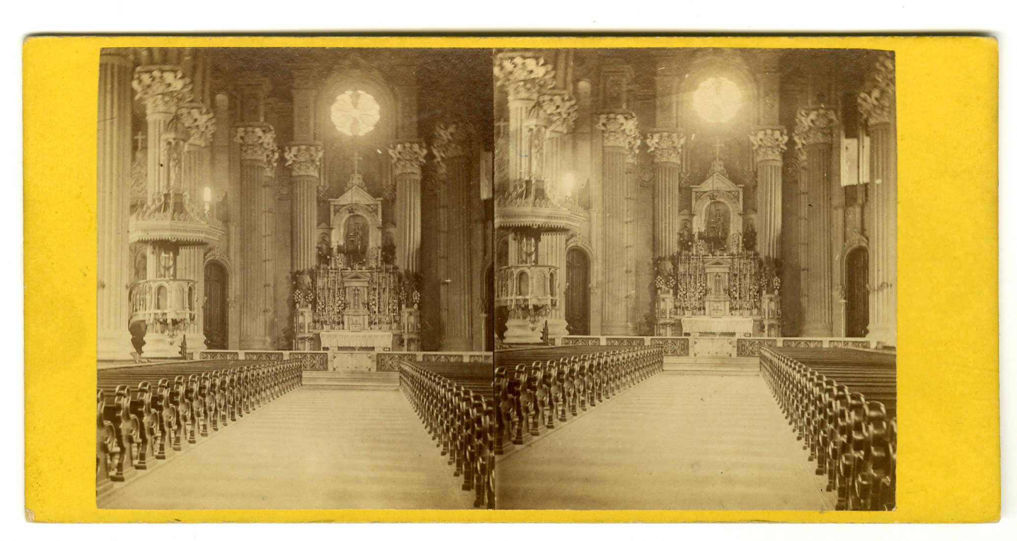
LOU203. Theo. Lilienthal, New Orleans. 4. Interior of St. Mary’s Church, Josephine Street. VG. $45
![]()
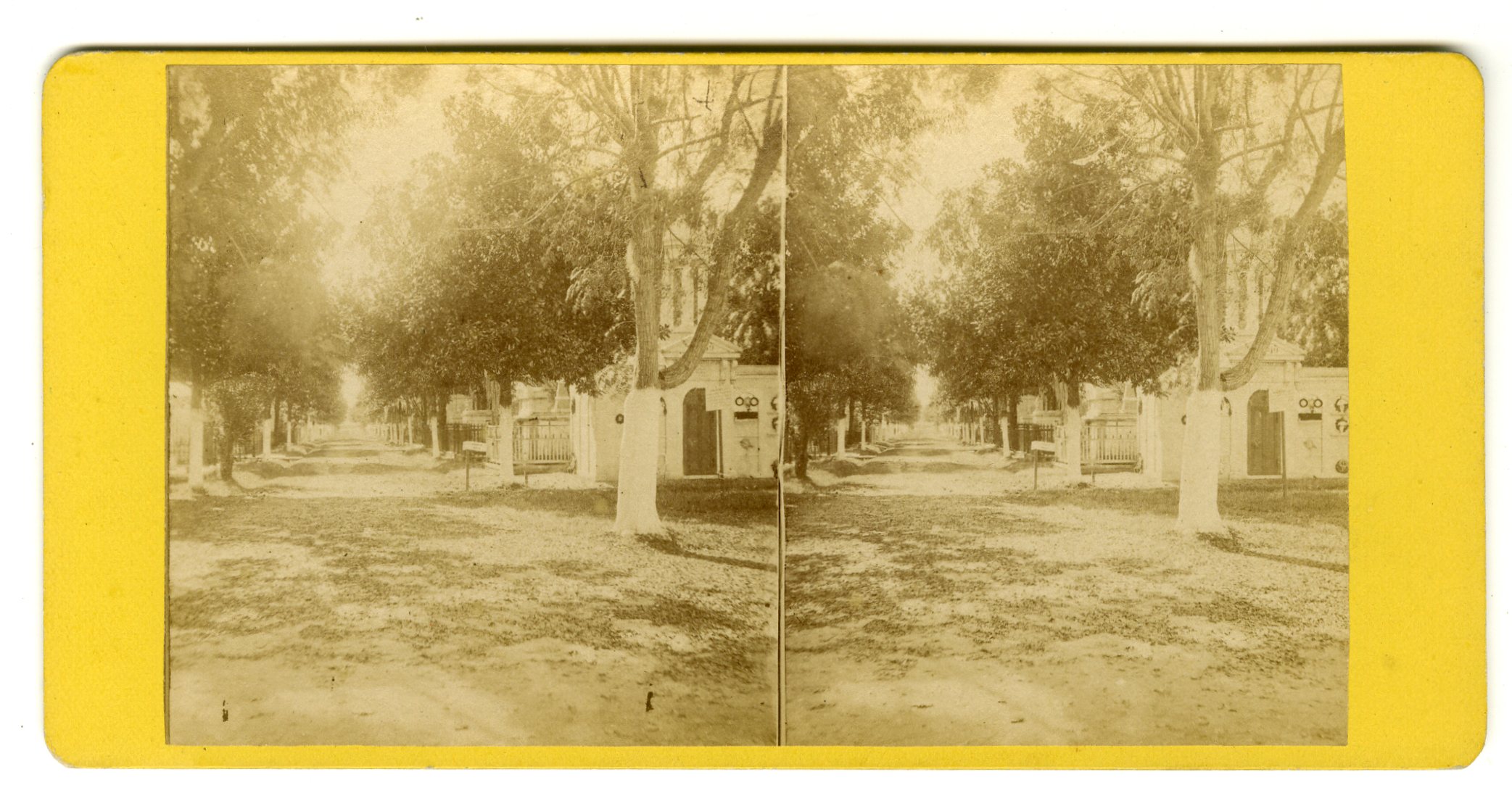
LOU205. Theo. Lilienthal, New Orleans. 2. Cypress Grove, or Firemen’s Cemetery. Foot of Canal Street. G. $35
![]()
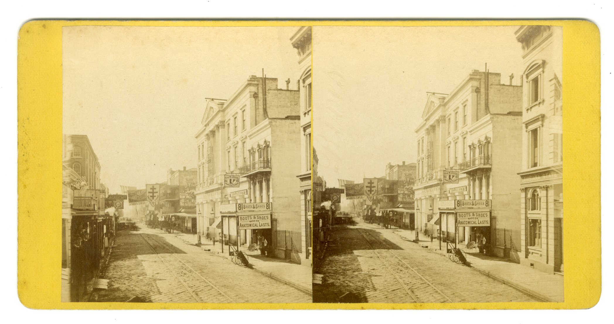
LOU209. Theo. Lilienthal, 45. St. Charles Street, showing Masonic Hall. VG. Sign for “Boots and Shoes made on Anatomical Lasts.” $150
![]()
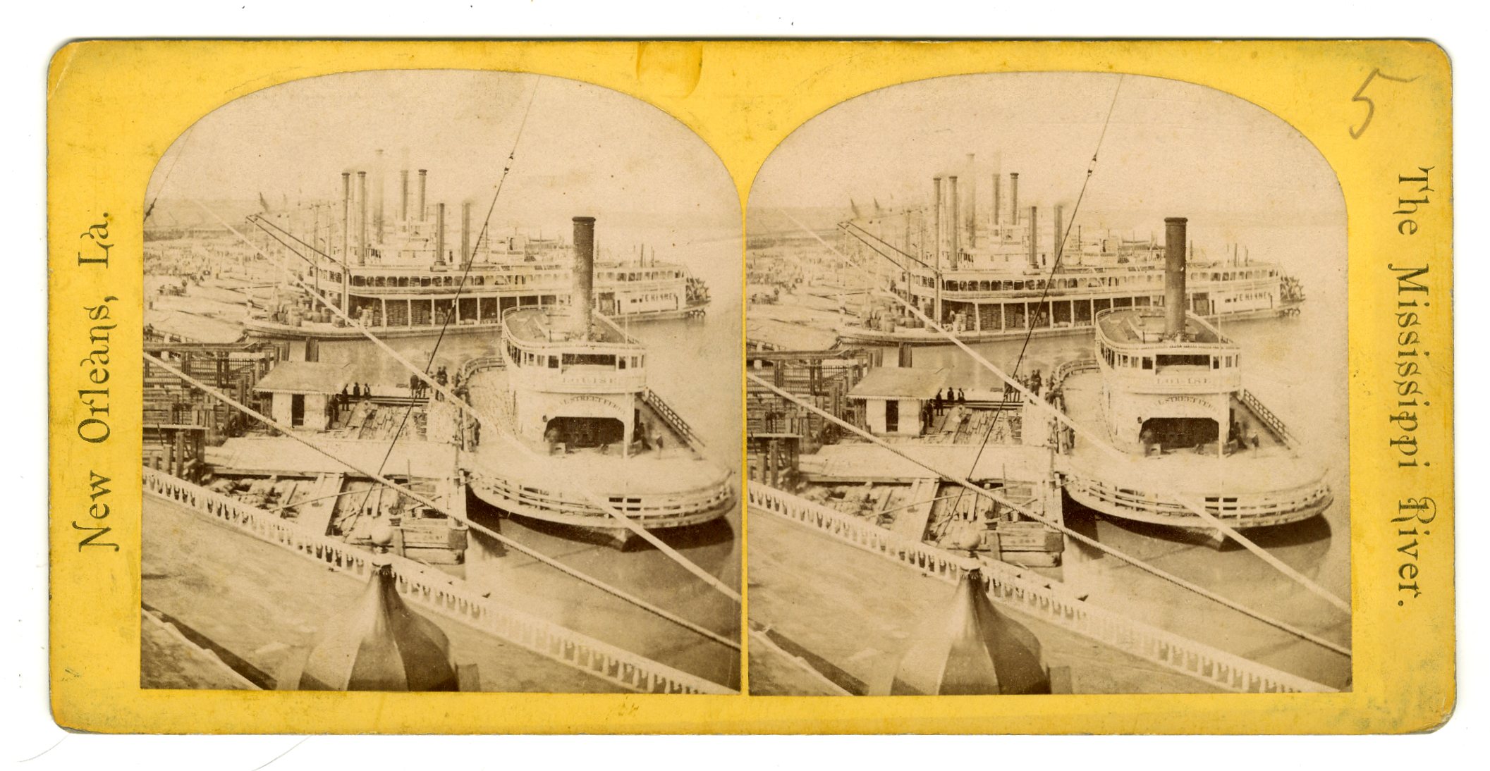
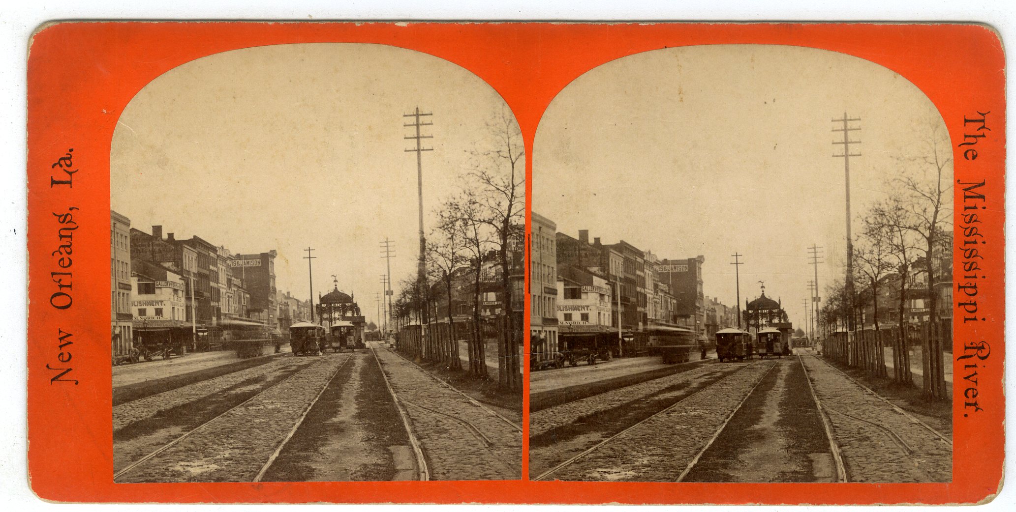
LOU213. New Orleans, La. The Mississippi River. No. 14. Canal Street Ferry Boat Louise. VG. $40
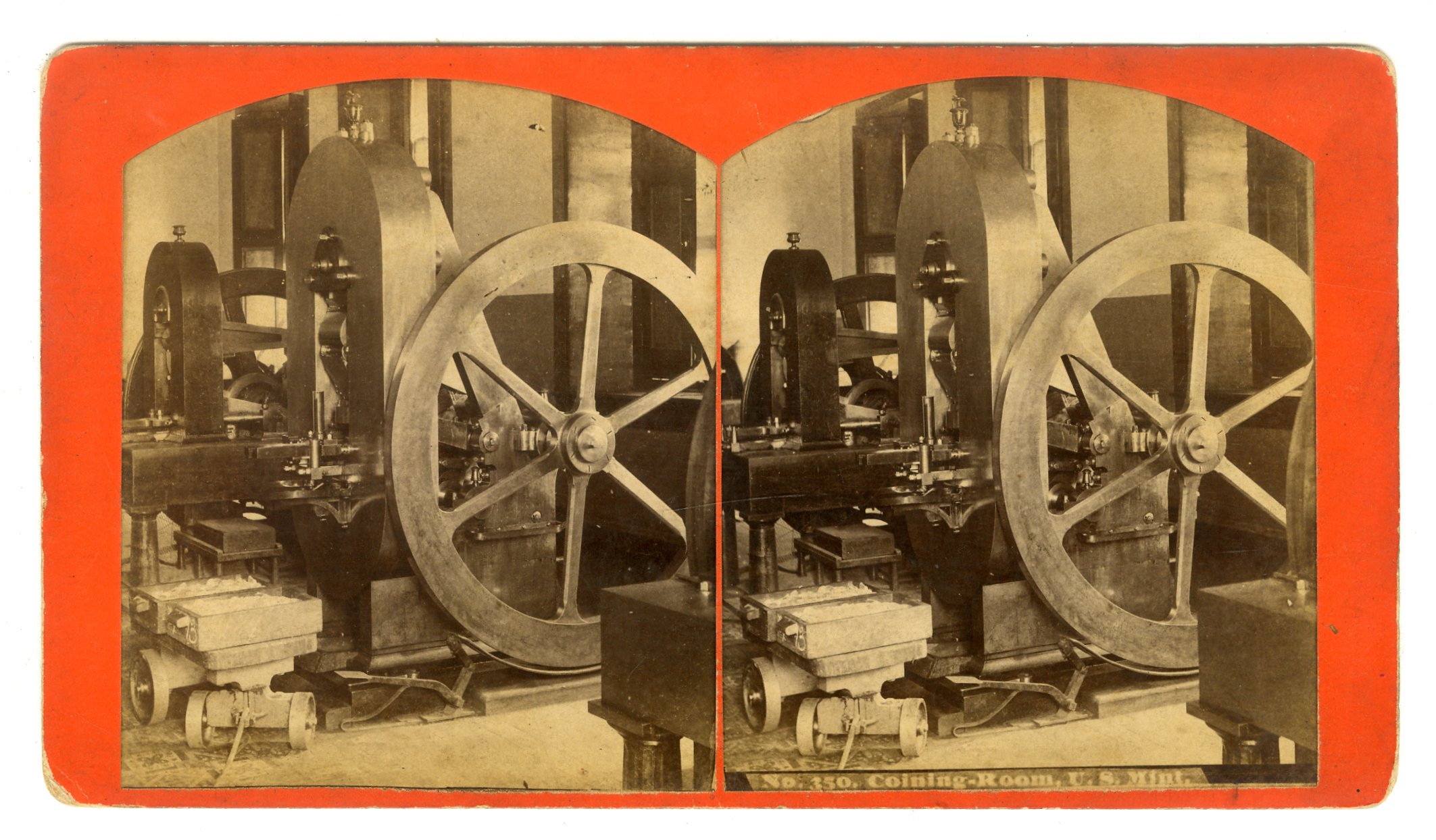
LOU214. [S.T. Blessing]. No. 350. Coining Room, U.S. Mint. VG. $175
![]()
LOU215. No. 26. Canal Street. F. VG. $85


LOU216. S.T. Blessing. Cemeteries of New Orleans. No. 5. City of the Dead. Main Aisle, St. Louis No. 2. G. $35
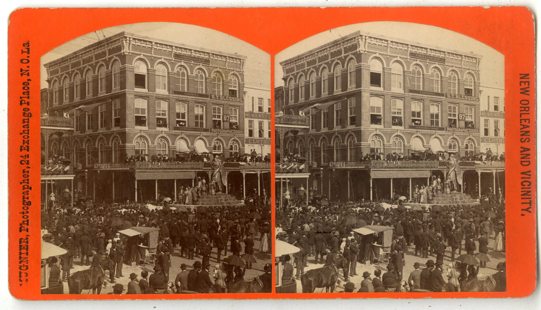
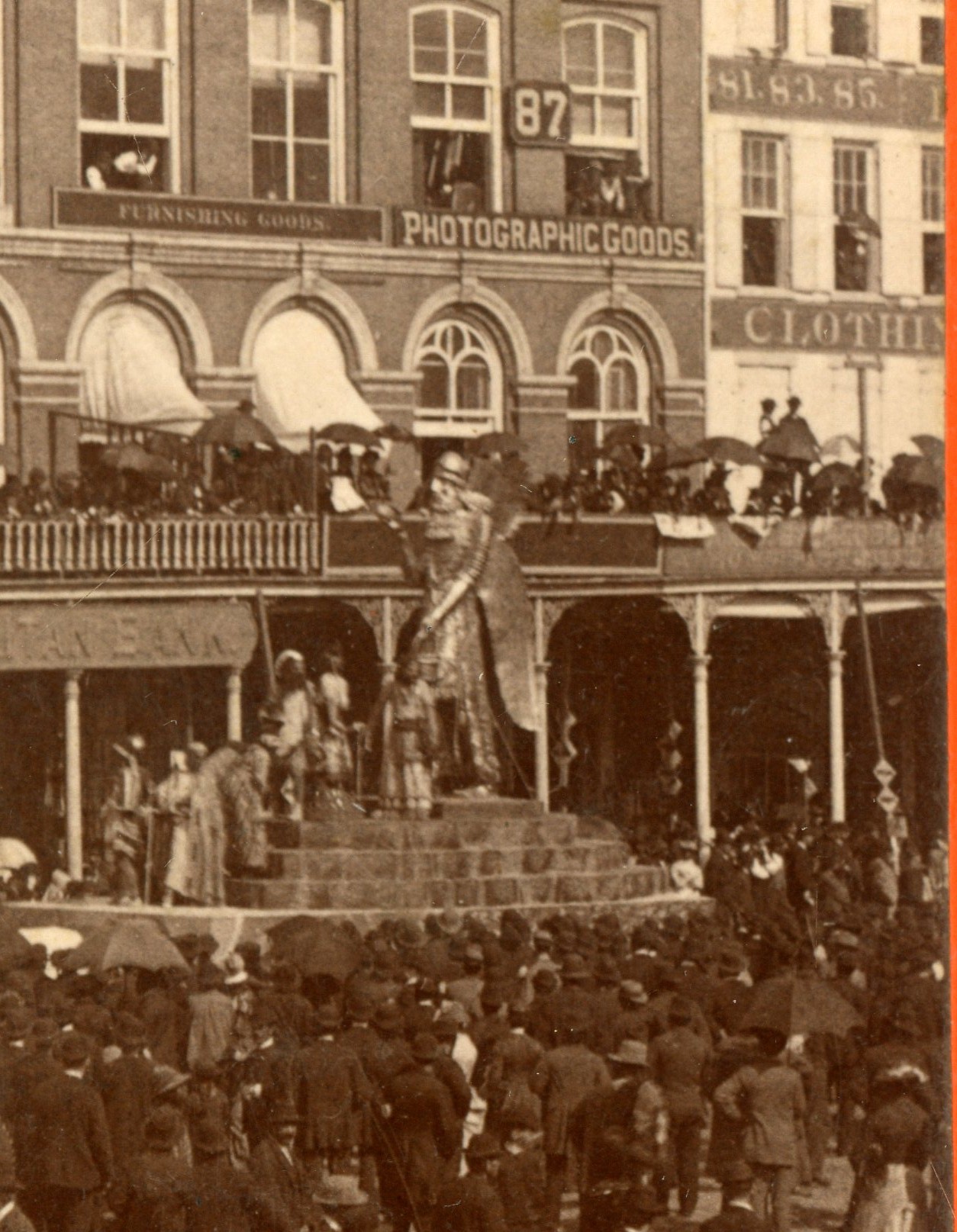
PH239. Mugnier, New Orleans. Although untitled, this is No. 359. Carnival Season: Canal Street. A float passes by the gallery of “S.T. Blessing, Photographic Goods,” at 87 Canal Street. E. $150